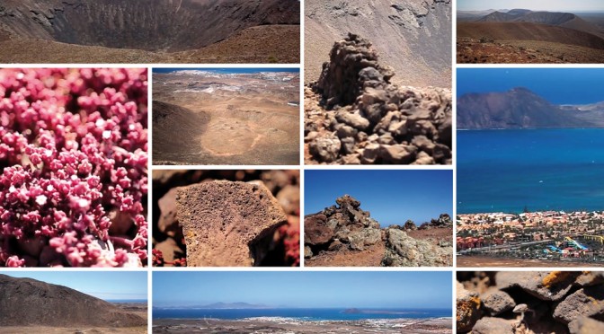
Fuerteventura is the oldest volcanic island in the Canary Archipelago, where volcanoes stopped being active 10.000 years ago (La Arena mountain). The fact of being the oldest island also explains why it is the most eroded one, the buildings and volcanic cones being erected on its almost flat surface which was a fire park in the past.
A great representation of the volcanic landscape is located in the north of the island, around Corralejo. This is known as the alignment of El Bayuyo, which are several volcanoes aligned between La Caldera in the islet of Lobos and Lajares (La Caldera de Lobos, La Montaña de Bayuyo, Las Calderas, La Caldera encantada, Caldera de Rebanada, Montaña Colorada and Calderón Hondo), with NE-SW orientation and being active at the same period (recent eruptions), which made Fuerteventura grow northwards around 112 kms2, and the neighbour islet of Lobos also appeared then, as well as “el malpaís”, so characteristic in the North of this majorera island.
The volcanoes in this alignment feature a round layout and their craters are shaped like calderas. In some of them, like La Caldera de Lobos, half of the crater broke off and slid, so nowadays it has a semicircular cone.
The tour of these volcanoes is highly recommended, either on foot or by bike or car, and they are much more attractive when walking from Lajares to Corralejo, as the wonders of the landscape join the immensity of the background sea.
The first volcanic structure, which gives its name to the alignment, is La Montaña de Bayuyo (279m), located on the village of Corralejo. It’s the first mountain you can see from Lanzarote and from the islet of Lobos, where we go everyday on our boat trips from Corraejo. In La Montaña de Bayuyo, like in Calderón Hondo, there is a pathway leading to the summit to watch the crater, and it’s an area where pre-Hispanic remains of round buildings made of dry stone are kept. They are supposed to have been used as dwellings and also as a shelter for the ancient inhabitants’ cattle.
A little further to the north-east La Caldera de Lobos (127m) erupted and half of its volcanic cone slid and submerged under the water. Following towards the NE-SW you find Las Calderas (248m), a volcano on whose foot we find several “hornitos”, which are a kind of mini-volcanoes or holes existing on the lava casting through which gases, and sometimes lava, were released. Then we find la Caldera Encantada (235m) and la Caldera de Rebanada (253m).
And finally, already getting to the little village of Lajares, we find Calderón Hondo (278m) and Montaña Colorada (248m). Calderón Hondo is one of the deepest and most perfect volcanic cones in the island (70m deep). The pathway that goes to the summit is prepared for the tourists who want to visit it, cobbled and signposted, it even has a viewpoint built to watch the caldera at leisure and landscape binoculars that offer breathtaking views of the north of the island.
Out of this alignment, a little further to the north-west, we find Montaña de Lomo Blanco and Montaña de la Mancha, whose volcanoes also released lava casting, thus gaining ground to the sea, although later on it would be overlapped by the lava casting from El Bayuyo. The word “Bayuyo” is a “guanche” term, comes from the “amazigh” and is related to spiritual matters: charmed clouds, floating objects or spirits coming from the sea.
From Fuertecharter, we encourage you to discover those wonderful volcanoes on foot or, if you want to venture on our boat trips, to find out their breathtaking views from the sea.
FuerteCharter’s Team