Hiking the island of Lobos

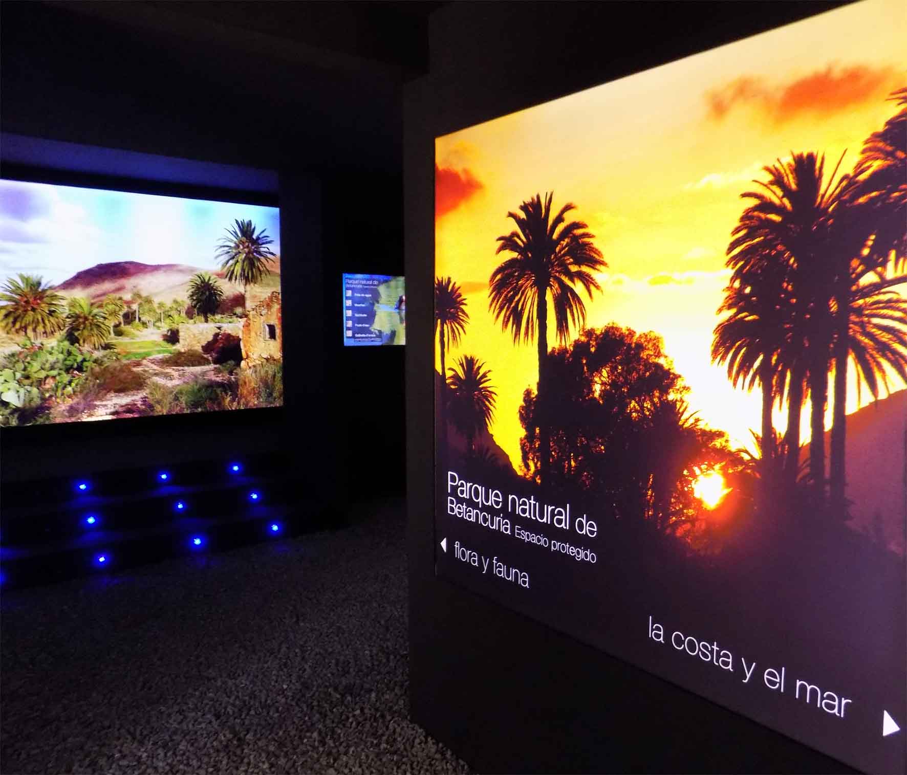
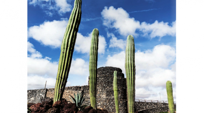
For those who enjoy nature walks, the island of Lobos, which we visit every day in our boat trips, is a beautiful enclave, which contains singularities that will astonish the hiker, being a Natural Park, which was declared as such in October 1982, when El Parque Natural de las Dunas de Corralejo e Isla de Lobos was created, and reclassified as Natural Park in December 1994.

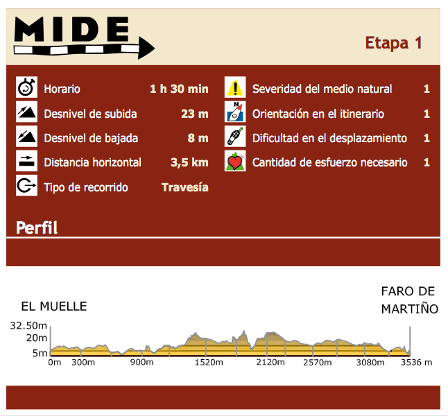
The following table lists the MIDE characteristics (communication system between hikers, with a scale that includes the technical and physical difficulties of the trails, to allow each hiker a better choice), where we can see that the difficulty of  the trail is minimal.

Fuertecharter | Trekking Lobos Islet

The trail that crosses the island represents the first stage of Fuerteventura GR-131 (long distance footpath linking the Canary Islands with the European path A7, about 5000kms, that departs from Hungary), so this step is particular, being in a separate islet to be accessed by boat.

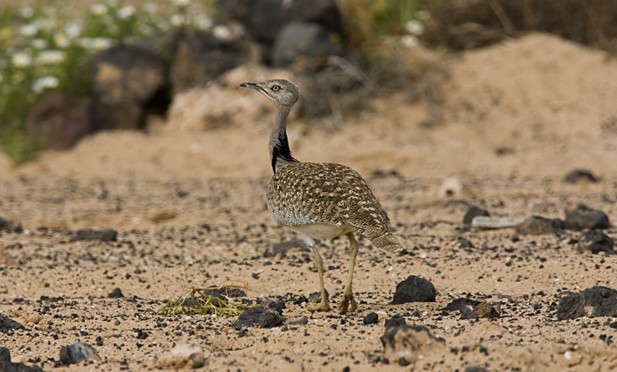
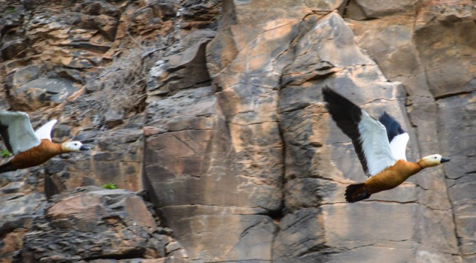
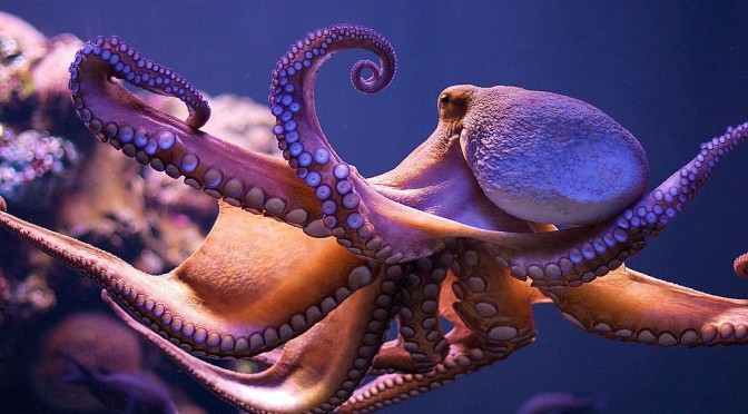
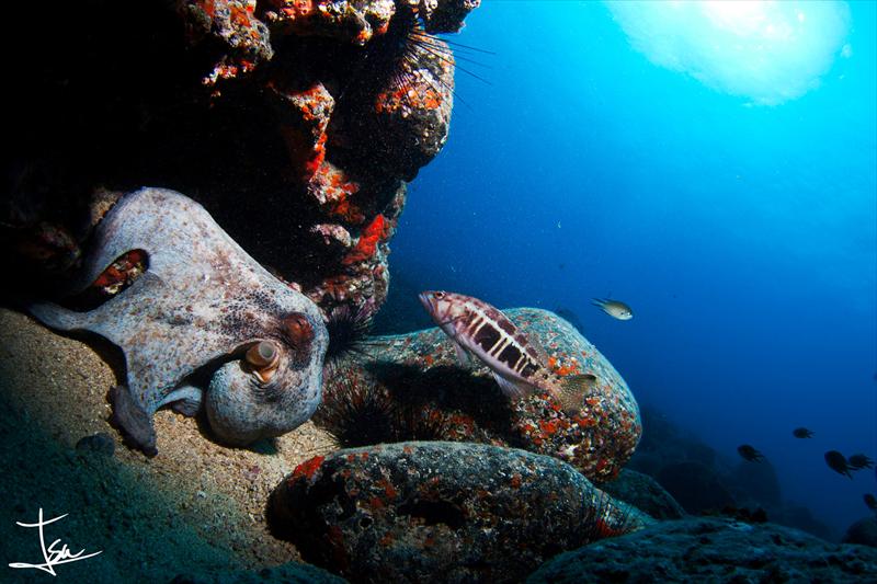
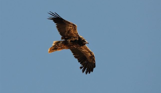
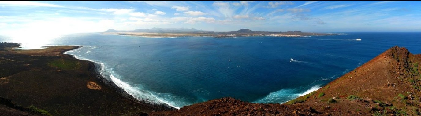
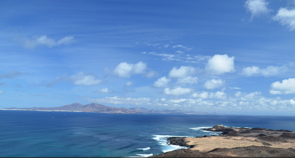
The adventure of this stage begins on the boat that takes you to Lobos Harbour, through what is known as El Río, a sea canal that separates the islet of Lobos from  Fuerteventura just over one mile and where if we look closely we can admire some of the marine species that ply these waters, such as turtles, flying fish and even dolphins and other cetaceans.

Lobos Harbour will welcome us with its calm turquoise waters, and once the sailing is over the  hiking adventure begins.

Upon arrival at Lobos Harbour we find two trails. We will take the one on the left, since the right trail leads to the houses of Puertito, which are not included in the tour, but we recommend visiting them at the end of this stage of the trail, because of its landscape beauty and calm.

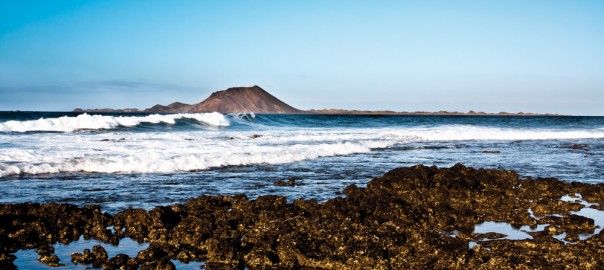
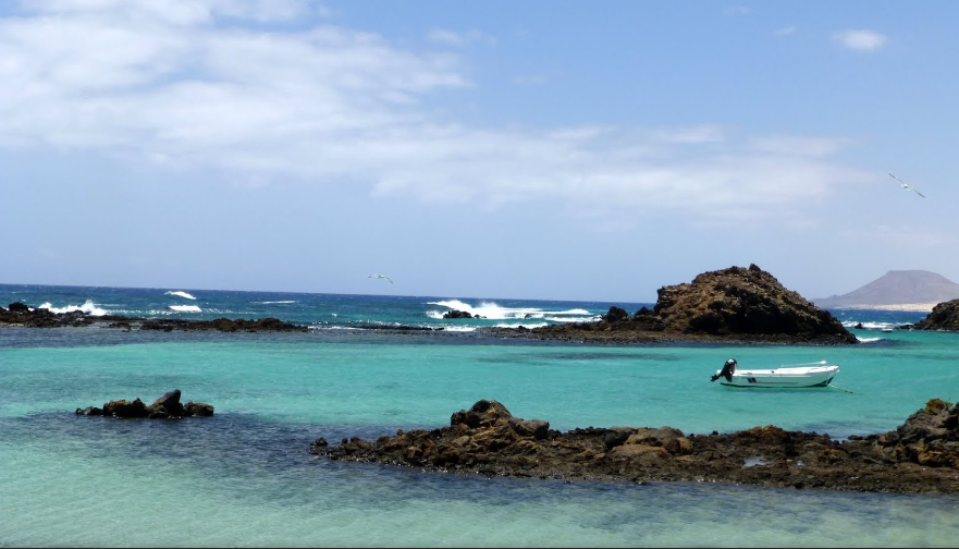
In the chosen path we’ll go through the volcanic “malpaís”, characteristic of the islet and the whole of Fuerteventura, up to Playa de la Calera (or Playa de La Cocha), with its fine sand and almost static water, which invite visitors to relax with water and sun baths.

Fuertecharter | Trekking Lobos Islet
©Peter Connolly

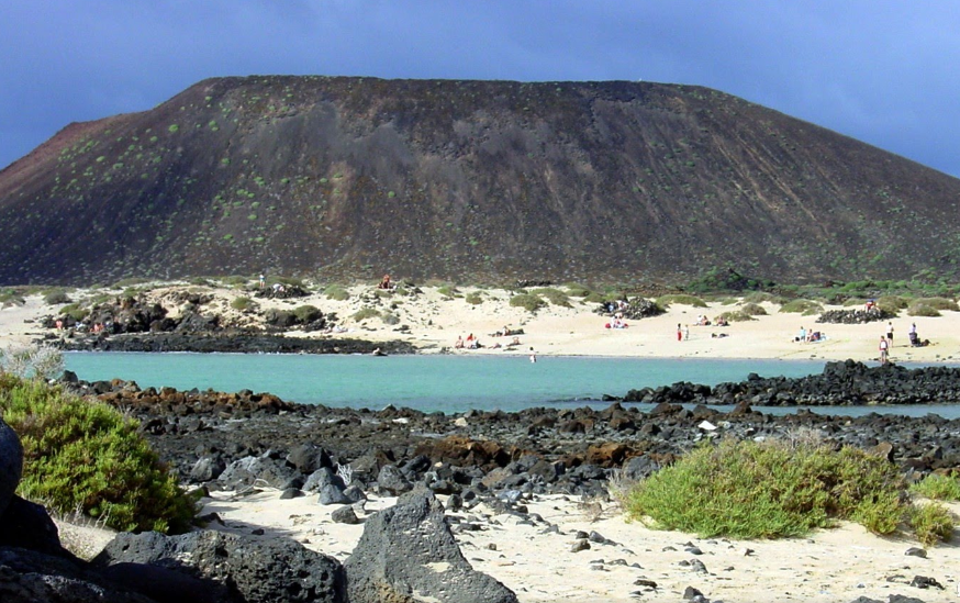
After a pause which can be used to take a dip, we continue the path, leaving the amazing Mountain Caldera on the left, with its 127-meter volcanic cone, swept away by the sea, which has turned the crater into a semicircular amphitheater at whose base the water breaks.

Fuertecharter | Trekking Lobos Islet
©Pedro I

We continue our journey, surrounded by the striking green of the Sweet Tabaibas (Euphorbia balsamifera), which are the exceptional inhabitants of this island, up to Caleta de La Madera, which we will sail round to finally get to Martino’s Lighthouse, located in the northern side of the islet of Lobos, which represents the final stage.

Fuertecharter | Trekking Lobos Islet
©bubueti

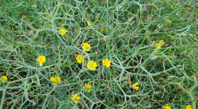
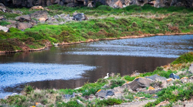
At this point there is a crossroads;  those who wish it can return the same path , but we suggest an alternative way (outside the GR trail), which also leads to El Puertito, crossing  Las Lagunitas, which are wetlands (salt marsh near the coast that is affected by the flow of the tide; the sea water is held and it makes ponds or lagoons parallel to the coast that allow the settlement of endemic plant species and also the least representative in our Islands; all these species have in common the adaptation to high salinity conditions), where you can find plenty of species, among which the houseleek (Limonium ovalifolium ssp. Canariense) stands out, endemic to the islet of Lobos.

Fuertecharter | Trekking Lobos Islet
©Alejandro Esquivel Ramos

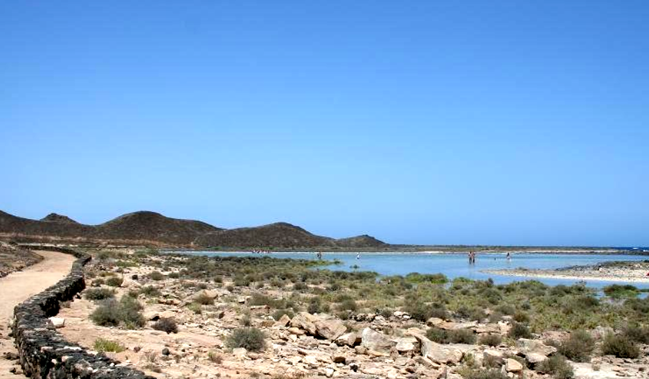
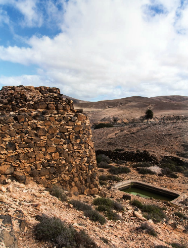
Through this path back we also find cisterns and lime kilns, which tell about  the history of this magical islet.

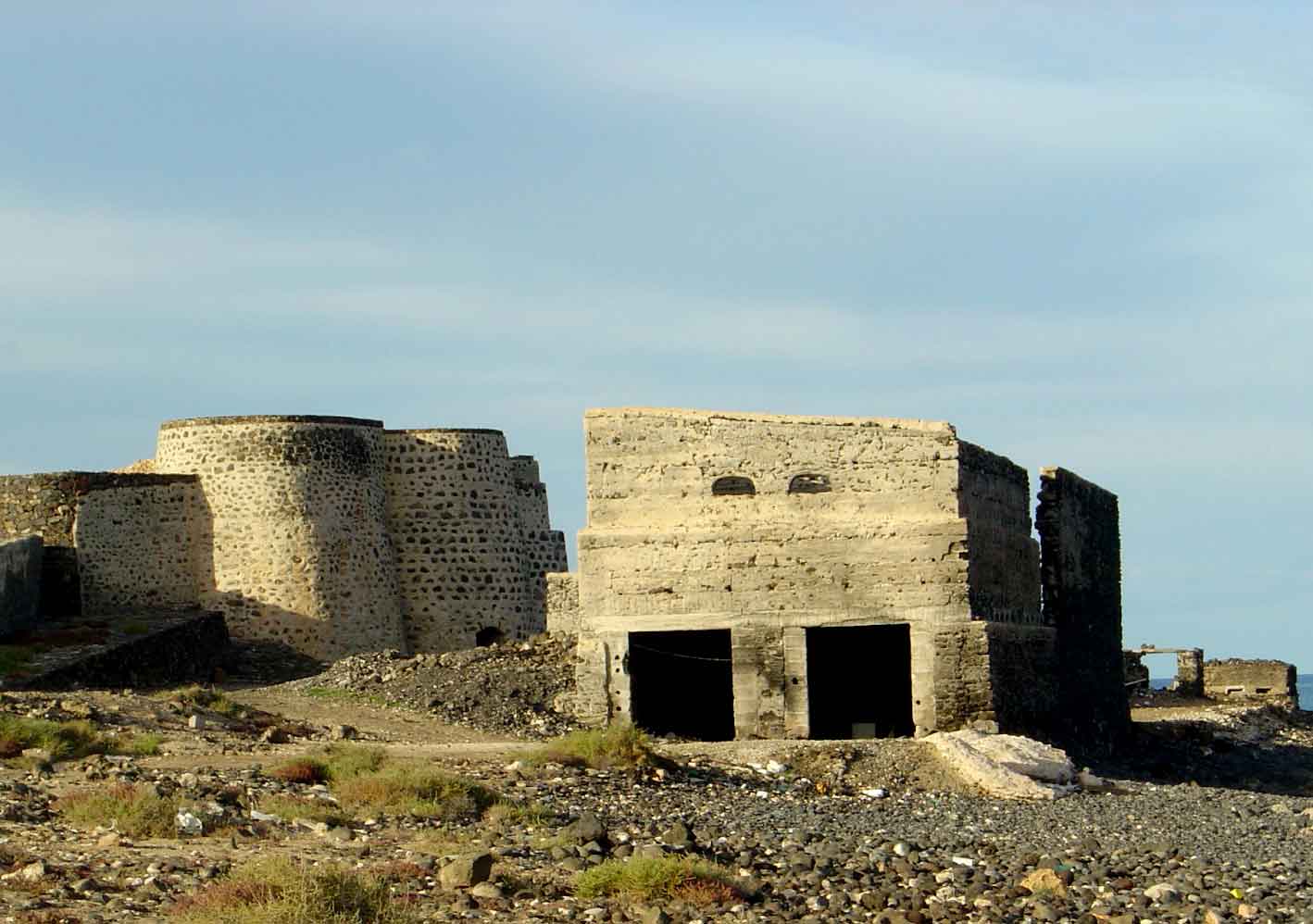
Finally we’ll get to the houses which make up the village of Puertito, old fishing settlement which fishermen often visit nowadays to spend the weekends, except some of them who still live on the islet permanently.

Fuertecharter | Trekking Lobos Islet
©Calvin Leung

If you follow the links in this article you will find all the information about this  paradise islet.
FuerteCharter Team.

Gorse blooming in Fuerteventura


If you’ve been lucky enough to take a trip to Lobos Islet from Corralejo you’ll have noticed, when setting foot on land, some peculiar and very characteristic thin greenish bushes: the gorse (Launacea arborescens). It’s just now (March) when these plants begin to bloom, a period which expands until June.

These shrubs are characteristic not only of Lobos and Fuerteventura but of The Canary Islands in general. In Fuerteventura and Lobos these shrubs you can be seen almost all over their surface, probably less common in the highlands.
It is a perennial plant, very abundant in the dry and arid lowlands in the Canary Islands. It can grow up to one meter, so they are not very high; their stems are thin, rounded and dull green.

FuerteCharter excursiones | Flora Fuerteventura

It’s so abundant and representative in our island that the famous writer, Unamuno, who spent his exile in these lands, dedicated a few words to this plant in “Artículos y discursos sobre Canarias”:

“La aulaga majorera, de Fuerteventura —se llama majoreros a los de Fuerteventura— tiende su triste verdor pardo, su verduras gris, por entre pedregales sedientos. La aulaga no tiene hojas, la aulaga desdeña la hojarasca; la aulaga no es más que un esqueleto de planta espinosa. Sus desnudos y delgados tallos, armados de espinas, no se adornan más que con unas florecillas amarillas. Y todo ello se lo come el camello, el compañero del hombre en esta isla, su más fiel servidor (…). Qué lección de estilo y de lo más íntimo del estilo, esta aulaga de Fuerteventura, es la expresión de la isla misma; es la isla misma expresándose, diciéndose; es la palabra suprema de la isla. En la aulaga ha expresado sus entrañas volcánicas, el poso de su corazón de fuego, esta isla entrañable.” Unamuno

We chose the words of this great writer because they describe, with beauty and wisdom, this so abundant bush in our Islands.
Throughout the years and being so abundant, this plant has had many uses, including the gorse yellow flowers which, on their own or in small bunches, were used in infusion for children suffering from jaundice. As already mentioned by Unamuno, it was also the favourite food of camels and goats.

FuerteCharter excursiones | Flora Fuerteventura

Whether you inhabit these lands or are just visiting it, in the coming months you’ll enjoy the flowers of this shrub, which is “the expression of the island itself.” If you’re lucky enough to accompany us on our trip to Lobos from Corralejo you will see this blooming paradise. We’ll be waiting for you.

FuerteCharter Team.

FuerteCharter excursiones | Flora Fuerteventura

FuerteCharter excursiones | Flora Fuerteventura

Foam salt, Fuerteventura

Throughout history, a whole cultural and commercial world has developed around salt. In Fuerteventura, already since the times of the Mahos (ancient aboriginal inhabitants), salt was part of their culinary culture, using salt water to cook and preserve food.

It’s already at the time of the conquest by the Spanish lords (1402-1496) when this sea resource begins to be used and managed, thus developing the salt farming activity.

Between the sixteenth and eighteenth centuries a true salt industry was created in Fuerteventura , with different areas of operation. Although currently only Las Salinas del Carmen (Antigua) remains active, as from the nineteenth century industrial processes left craft aside,  in ancient times there were farms in La Hondurilla (Caleta de Fuste),  El Charco (Puerto del Rosario), Gran Tarajal and the island of Lobos in Marrajo area where, in our daily trips to the neighbouring island, the remains of these salt farming areas can still be observed.
Today, thanks to the creation of the “Centro de Interpretación de la Sal” in Las Salinas del Carmen, the ancient craft of salt maker has been kept, and the visitor can discover how salt is produced on the island in the traditional way.

Salt marshes are characterised by two factors:
- First, to produce salt on clay soils where, when water evaporates, the salt that is produced also acquires salts  from the soil, so their nutritional values ​​are much richer.
- And second, because the sea water used in these salt marshes is surface water, which is the best. Generally, in other salt marshes, sea water is transported to the cookers through pipes using pumps, so it is water from the depths, but at Las Salinas del Carmen water directly gets into the salt marsh after breaking the waves, therefore, what comes in is actually lots of whipped foam, which produces a high quality salt: what is known as foam salt.
So this  foam salt from Fuerteventura is a premium product which is becoming a gourmet product in some markets such as Japan, and it is easier to find in fine dining restaurants.
Numerous studies have shown the benefits of this salt foam in contrast to common salt.

Process
Once the wave breaks and enters the salt marsh, it’s directed to the heaters, which are some areas where water is reserved for 8 to 10 days, to get heated.
After these days, the salt maker takes it to the cookers or pits, where it remains another 15 or 20 days, and water evaporates in the sun, leading to the formation of salt crystals. During this period the salt maker should mix the piles of salt with a rake twice a day, at sunrise and sunset, so that  the crystals that are formed on the surface go to the bottom and allow the formation of more crystals. This is what is known as salt skimming.

Excursiones FuerteCharter | Sal de espuma de Fuerteventura

© pellagofio.es

Then salt piles in “balaches”, which are edges  of cookers or pits, and there it remains piled for a week, and from there it goes to the warehouse to be packaged.

Excursiones Fuertecharter | Sal de espuma de Fuerteventura
© cabildofuer.es

Generally the process of obtaining salt starts in March, and it often extends to October (some years even later,  if the rainy seasons hasn’t started). The rest of the year the work of the salt maker is to keep the salt in perfect conditions, cleaning the pits in depth and building new ones for the next season.
We recommend a tour around Centro de Interpretación de la Sal de Las Salinas del Carmen, where visitors can discover all the ins and outs of this craftsmanship so related to the sea around us.
Hours: Tuesday to Saturday, 10am to 18pm.

FuerteCharter Team


Birds: The Canarian Houbara, inhabitant of The Islet of Lobos, Fuerteventura and Lanzarote


The arid, wild and pristine islet of Lobos —which we passionately show to the visitors who join our day trips from Corralejo— is one of the few places along with Fuerteventura, Lanzarote and La Graciosa, where one of the most unique bird in the Spanish wildlife lives, the Canarian Houbara. Its habitat are the arid landscapes, “jables” and “malpaís” characterizing the eastern end of The Canary Islands.

The Houbara or Houbara Bustard (Chlamydotis undulata) is a species of “gruiforme” birds from the Otididae family, fully adapted to living in dry and poor lands; It is an omnivore, a terrestrial and lonely bird found from Mauritania to Egypt and from Sinai to Mongolia, the small settlement in The Canary Islands being unique in Europe. The subspecies inhabiting our islands is fuerteventurae, which is endemic to The Canary Islands.

FuerteCharter excursions Fuerteventura | Birds: The Canarian Houbara
© AurelioMartín
www.canariasmedioambiente.com

Description

Thin and elongated neck, grey and white shades, it features a comb or small bun of black and white feathers, usually flashier in the male. The chicks, more similar to males, have the duller plumage. Actually this bird seeks to go unnoticed, is easily scared and jealous of its privacy and it seeks to be relaxed for survival so its plumage usually blends in with the landscape except in the mating season. With 170 cm wingspan, it is the largest bird nesting in The Canary Islands. Their diet is varied both animal matter (beetles, grasshoppers, ants, caterpillars, snails and small lizards) and plants (flowers, sprouts, fruits and seeds).

Although the Canarian Houbara is sedentary it can act like the migratory birds, making journeys in search of similar habitats and even flying between islands.

FuerteCharter excursions Fuerteventura | Birds: The Canarian Houbara
© www.canariasmedioambiente.com

Reproduction, wooing and breeding

Regarding the breeding season, although variable, we can say that it normally starts between February and March and it begins with a wooing which is most interesting since the male performs solo shows, a real dance in which their plumage become more attractive so as to draw the females attention; they spread out the white feathers on their crest and neck, moving in circles and straight; from a distance a flashiest white ball, which changes colour, can be seen, a spectacular wooing dance.
Once the female is captivated , after copulation, the male ignores the upbringing and it’s the female that is in charge alone. It usually lays two or three eggs which she incubates for about 23 days, after which the eggs hatch and the chicks are able to move soon after being born and they will be raised by their mother for about 35 days; perhaps occasionally the male may cooperate, but not generally. The chicks usually remain with their mother until the autumn.
This endemic bird of the islands, so special and of which we may have about 800 specimens in the archipelago, is listed as an endangered species, threatened with losing their habitat, their peace and quiet, as a result of urban and tourism development and, particularly in Fuerteventura , by the new highway that goes through the quiet and sparsely populated areas that have become home to these peculiar and solitary birds. For the preservation and survival of the species it is essential to protect their habitat.


Threats and preservation

The preservation measures started in 1985 with the drafting of a recovery plan and management programs, education and awareness and implementation of a captive breeding plan. Since 1993, SEO / BirdLife is carrying out preservation projects in Fuerteventura, subsidized with funds from the EU LIFE program. In 2005, this NGO acquired a 200-acre farm, El Cercado de El Jarde, aimed to protect this species, where 18 specimens have been living along with several other species of the “majorera” wildlife.

It ‘s a bird that could be classified as difficult to see despite being a terrestrial animal since, as we previously said, it’s very jealous of its privacy, but let’s not lose hope because it is common to see it in very quiet areas running around elusively among the gorse. If you are a respectful traveller and concerned about respecting the peace and quiet in these arid areas they inhabit you are much more likely to enjoy them. As for us, on our trips to the Islet of Lobos from Corralejo, we are very attentive when we set foot on the islet because although it is not the most common bird sometimes we are lucky to see them running around in this little paradise that The Islet of Lobos is. 


FuerteCharter Team

The house of Nature: fauna and flora in “Parque Natural de Betancuria”

Just one week ago  the House of Nature opened in the town of Vega de Rio Palmas,, a space dedicated to the exhibition of fauna and flora wonders in the Natural Park of Betancuria in Fuerteventura.

This house, built on the ruins of an ancient majorera house, is owned by the German Reiner Loos, who has been living in Fuerteventura for 20 years, and has managed to give a touch of fantasy to this place, raising a rustic-style building with lots of vegetation and gardens, and with a restaurant for visitors to rest, if they come from the path SL FV 27 (Barranco de las Penitas-Vega de Rio Palmas), enjoying the majestic views of Betancuria mountains.

Fuertecharter | fauna y flora Parque Natural Betancuria

In this House of Nature you find a really modern exhibition hall, where visitors can discover some of the unique fauna and flora in the Natural Park of Betancuria.

Fuertecharter | fauna y flora Parque Natural Betancuria

This park became a National Park in 1987, and in 1994 it also became a Rural Park, the “Natural Monument of Ajuy”being then included in their confines.  It is also a ZEPA  area (Special Protection Area for birds).

The Park includes the area in the west-central sector of the island, covering an area of ​​16,544.3 hectares in the municipalities of Betancuria, Antigua, Puerto del Rosario, Pájara and Tuineje (as you can see in the picture below).

Fuertecharter | fauna y flora Parque Natural Betancuria

This area corresponds to the basal outcrop in Fuerteventura, and it also presents sub-aerial volcanic series, so the colour and structural peculiarities of this area are stunning. There are moderate mounds that intermingle with U-shaped deep ravines. The most prominent peaks of this massif are Morro Jana (764 m), Gran Montaña (708 m), Morro de la Cruz (676 m) and Morro Velosa (669 m), major mountains considering the island scenario.

The existence of mountains and canyons are participant of the great variety of vegetation that exists, many of these rock plants being considered as endangered and protected species.

You can find there endemic species from Fuerteventura , but also from The Canary Islands and the whole of Macaronesia. In lower areas we find a blanket of sparse grass, with few trees and many shrubs, mainly sweet spurge (Euphorbia balsamifera), “cuernúa” (Caralluma buchardii), “ jorjao” (Nauplius asteriscus seiceus), gorse (Launaea arborescens is given ), the cactus (Euphorbia canariensis) and “salados” (Sarcocornia perennis). In ravine funds there are tamarisks (Tamarix canariensis and T. africanus), palm trees (Phoenix canariensis), reeds, rushes, etc. Among the introduced species the mime (Nicotiana glauca) stands out, as well as  the population of pine trees known as “Pinar de Betancuria”.

Fuertecharter | fauna y flora Parque Natural Betancuria

The same can be said about its wildlife, with great variety, especially on humid ravines and inland areas, where you can find native birds such as the  majorero vulture (Neophron percnopterus majorensis), the tit (Parus caeruleus degener) and the canary (Serinus canaria), and other migratory birds such as the marbled teal (Marmaronetta angustirostris) and the Ruddy Shelduck (Tadorna ferruginea).

Fuertecharter | fauna y flora Parque Natural Betancuria

The habitat that stands out is not only the mountain, but also The wetland in the dam of Las Peñitas , Los Molinos, and the coastal cliffs are of great importance. In these cliffs, specifically in the town and Ajuy, you can find important deposits of ancient remains, with ocean sediments and fossils of already extinguished marine animals. The waters in this part of the coast are inhabited by species such as the whale shark, sea turtle, swordfish, sparidae, whales, rays…

Fuertecharter | fauna y flora Parque Natural Betancuria

Fuertecharter | fauna y flora Parque Natural Betancuria

In the House of Nature, visitors can enjoy an exhibition with photos, videos and information on these species of the Flora and Fauna in the Natural Park of Betancuria, besides a projection room where a multi-screen film is exhibited, which portrays the island in all four seasons.

Fuertecharter | fauna y flora Parque Natural Betancuria

Part of the exhibition hall is dedicated to ecological disasters that produced tar in the Galician coast (Prestige) as a protest to this industry and a rejection of the implementation of these platforms on the shores of our paradise.

Fuertecharter | fauna y flora Parque Natural Betancuria

Fuertecharter | fauna y flora Parque Natural Betancuria

Hours: 10 to 17h. Closed on Tuesday.

FuerteCharter Team

Fuerteventura, paradise for birds: The Ruddy Shelduck


As you know every day we depart from Corralejo pier for our catamaran excursion to Isla de Lobos, a magnificent tour in which  we don’t only enjoy the wonders of the sea but also of the wonders of the sky, since they are many the birds flying over us in this beautiful island of Fuerteventura.

For several months we have been lucky to see, more and more often, some birds that look like geese; they even honk like them and we usually see them in couple. This is the Ruddy Shelduck or Tadorna ferruginea, which is a species of bird from the Anatidae family, fairly widespread in Asia and North Africa.
We can boast of  Fuerteventura currently having the largest population of Ruddy Shelduck in Spain. Although in the past they used to spend the winter in the peninsula and sometimes nest in Andalusia, they currently nest exclusively on our island.

FuerteCharter Excursiones Fuerteventura | birds: The Ruddy Shelduck

© Ricardo Herranz

Description:


Common name: Ruddy Shelduck
Scientific name: Tadorna ferruginea
Weight: 1.3-1.6 kg.
Size: 61-67 cm. long.
Wingspan: 110-135cm

As we have already discussed, The Ruddy Shelduck looks like the goose, with long neck and legs. Its head is cream whereas its tail is black with black wings except  at the front, which is white above and below; its body is reddish tan. The male has a narrow black necklace and the female stands out  because its face mask is more prominent.
Where do they live?
In Fuerteventura they live in the wetlands and the ponds inland, these shallow waters being their favourite breeding areas, so they can graze on their edges. It is really common to see couples in the ponds in Los Molinos, Catalina Garcia (Tuineje), and La Rosa del Taro (Puerto del Rosario) … these wetlands have become nurseries for the raising of chickens after the breeding season, which started between January and February.


Feeding

They feed on stems and  alfalfa sprouts, seeds and typical dry-land insects, as well as worms in wetter soils. They usually eat at dusk and dawn.


Breeding

They usually lay between 8 and 10 eggs which are incubated by the female about 28 days, while the male defends and doesn’t go too far  away. They lay an egg per day and they begin to incubate them once the clutch has finished. When they are born they are able to feed rapidly ; even so, the couple still protects them and devotes about 55 days of care, until they can fend for themselves.
The first couple to arrive  in Fuerteventura was in year 94 and experts believe they did  in a natural way; currently we are believed to have a population of over 300 specimens.
Although it is a migratory species and there were periods in which they totally disappeared from the island, probably because they went to the wetlands in North Africa, it is now common to see them throughout the year, probably because this island is not very crowded and has wetlands similar to the African ones.  Surely this year is more common to see them and its population has grown as this autumn has been rich in water.

Despite boasting of population we must not forget that men and their lifestyle are a major threat to this species as they are responsible for the destruction of their habitat and, specifically in Fuerteventura, the extraction of water from ponds for irrigation. Also poaching and the plundering of nests are circumstances that threaten this species.

The Ruddy Shelduck is included in “El libro Rojo de las Aves de España” as “critically endangered species”  and it is listed in the category “Of special interest” in “El Catálogo Nacional de Especies Amenazadas”.
From FuerteCharter we’ll keep enjoying these couples we see from our catamaran in our daily excursions from Corralejo to the wild and unspoiled islet of Lobos.


FuerteCharter Team

Common Octopus: blue blood in the waters of Fuerteventura

Cover photo: © M.Brekkevold

The most elusive cephalopod Mollusc in the waters of the Mediterranean and Eastern Atlantic, Octopus vulgaris, is one of the jewels that inhabits the rocky and sandy bottoms in Fuerteventura, up to a depth of 329 feet.

The word octopus comes from Latin polypus and literally it means “many feet.” It has 8 arms,  6 out of which have two rows of suckers which, according to scientific studies, are used to manipulate objects and prey and the two rear ones, to scroll through the rocks. The common octopus, unlike other Cephalopoda such as the squid, has no tentacles. Tentacles are long extensions, longer than  arms, which help them capture their prey. This is a good feature to differentiate octopus from squids, as squids, besides 8 arms, also have two tentacles.

As a means of locomotion octopus don’t only use their arms; they also have a ventral siphon that helps them swim very quickly by means of high-pressure water-jets.

Like all Cephalopoda, the common octopus has “blue blood” (instead of haemoglobin it has haemolymph, with atoms of copper instead of the iron that blood usually has. The copper oxide gives a bluish tint, while iron oxide is red ).

Its body is soft and without shell, which gives it great flexibility to change shape and the possibility to get into really small cavities.

The octopus skin is another feature that makes them unique beings,  with three types of pigment cells, one of them which causes their colour change, and two others that enable them to reflect and refract light so they can change colour very quickly. Presumably thanks to this they have managed to develop a complex communication system based on changes in colour and texture of the skin, expressing moods, which plays an important role when it comes to mating and also as a way of deterring predators, to which it also misleads by means of ink secretions.

The common octopus has three hearts (two of them which bring haemolymph or “blood” without oxygen to its gills and the third one which carries oxygenated haemolymph to its body) and nine  brains, eight small ones connected to each of its arms and one general one that coordinates all of them. This tuns it into the invertebrate with the most developed nervous system that exists. Its intelligence is comparable to that of some mammals, featuring memory and learning ability.

Fuertecharter | Common Octopus in Fuerteventura
©isaias Cruz

Its head usually measures around 10 inches, and its arms, around 40, although sometimes it can reach a total length of up to 10 feet. Its diet is mainly carnivorous, based on small fish, crustaceans and molluscs, which it crushes with its hardened beak-shaped jaw, similar to parrots’. It usually hunts at night and during the day it remains hidden in the hollows of the rocks.

Cannibalism is usual in this species, especially near the mating season, which usually takes place in spring and autumn, act that makes them be together momentarily as the rest of the time they are solitary animals.

The relationship between height and weight show positive allometry: males are heavier than females at a given size. Longevity in both sexes is usually 12 to 18 months.

The female protects the eggs they lay for 25-65 days. In this period it consistently beats the water to oxygenate it and it doesn’t eat, so many of them die when the eggs hatch. Once the eggs hatch, the offspring live as plankton for about two months, until they take the habit of living at the bottom.

Fuertecharter | Common Octopus in Fuerteventura
©oceanoecimat

Its delicious flavour has turned the octopus into one of the most popular dishes in Galician cuisine, which has spread to the rest of Spain the way of cooking it (after cooking, it is served sprinkled with paprika, cut into 1cm slices and with olive oil and coarse salt), and it’s a real attraction for tourists. This has led to overfishing in recent decades, which has resulted in a decrease in both the number and the size of the specimens.

In the waters off the coast of Fuerteventura and Lobos islet is often common to find  Octopus vulgaris specimens, hidden in puddles and among cliff cavities. In the snorkeling activity we carry out in our trips to the islet of Lobos it can sometimes be observed, though you have to look very carefully as this specimen is a master of camouflage and oversight, and it can vanish in front of our eyes behind a smoke bomb in the form of ink, as if it were a magic trick.

FuerteCharter Team

Wetlands in Fuerteventura and Isla de Lobos, sources of life

Despite the aridity that characterizes our paradise, Fuerteventura has several wetlands of great importance, but above all there is one that draws our attention particularly because we visit it on our daily excursions from Corralejo; this is known as “Las Lagunillas de la Isla de Lobos”.


But what is a wetland?

“A wetland is an area of land that is temporarily or permanently flooded, due to climatic factors, and in constant interaction with the creatures that inhabit it”. They are also “The areas of marsh, fen, peat-land or water surfaces, either natural or artificial, permanent or temporary, static or flowing, fresh, brackish or salt, including areas of marine water whose depth at low tide does not exceed six meters. ” Ramsar Convention.

FuerteCharter Excursiones Fuerteventura | Humedales

Fuerteventura Wetlands

On our island, because it is a semi-arid area, wetlands are critical to the survival of both plants and animals, especially some birds we have so much discussed in this blog. As we have told you many times, hundreds of birds find in the wetlands of Fuerteventura the ideal shelter to spend the winter, rest or carry out important tasks such as breeding.

Ramsar Convention

Since 1971 the Ramsar Convention has been an international instrument for the protection of these important ecosystems. In 1982 this Convention is enforced in Spain with the inclusion of Doñana National Park and “Tablas de Daimiel” as wetlands, and in 2002, what had been a marginal area in Fuerteventura, annexed to the beaches, “El Saladar de Jandia”, was included, thus becoming a main place in the work of restoration of biodiversity in the island. This wetland covers an area of 1,270,000 m2 and so far it’s the only one in the Canary Islands which has been included in the Ramsar Convention.

FuerteCharter Excursiones Fuerteventura | Humedales

Most characteristic wetlands in Fuerteventura

But as we mentioned, Fuerteventura has important wetlands scattered throughout the territory and whose visit is a must for bird lovers that visit us year after year; this year with the “abundant” rain falls in January the wetlands are even more resplendent.
The best known: “El Barranco y La Presa de los Molinos” and “Las Fuentes de Chupadero” in Matilla (Puerto del Rosario), “ Las charcas de Rosa” belonging to Catalina Garcia (Tuineje), “La Presa de Las Peñitas” and “El Barranco de El Junquillo” (Betancuria).

One of our favourite wetlands, which we visit daily on our trips from Fuerteventura to Lobos island, is known as “Las Lagunillas del islote de Lobos”. It’s a salt marsh near the coast which is affected by the tide flow; the sea water is retained there and ponds or lagoons are formed; they’re parallel to the coast, which allows the settlement of endemic plant species and also some of the least representative plants in of our archipelago. All these species have in common their adaptation to high salinity conditions.

FuerteCharter Excursiones Fuerteventura | Humedales

Major wetland birds settled in Fuerteventura:

Ruddy Shelduck (Tadorna ferruginea), the coot (Fulica atra), the common stilt (Himantopus himantopus), the Kentish plover (Charadrius alexandrinus), the sanderling (Calidris alba), Common Sandpiper (Actitits hypoleucos), the marbled teal (Marmaronetta angustirostris), Eurasian Spoonbill (Platalea leucorodia), little egret (Egretta garzetta), gray heron (Ardea cinerea), clear redshank (Tringa nebularia), Ruddy turnstone (Arenaria interpres), the whimbrel (Numenius phaeopus )

The vegetation that stands out in the wetlands of Fuerteventura:

Halophytic vegetation formed by “el mato” (Sarcocornia fructicosa), Shrubby sea-blite (Suaeda vera) and “la uvilla” (Zygophyllum fontanessii); the reed (Phragmites australis), “el tarajal” (Tamarix sp.), the sea lavender from Lobos (Limonium bollei) endemic to the island. They are plants adapted to high salt conditions, even resisting periodic seawater floods.

Need for conservation and protection

We must not forget that they are ecosystems very threatened by myriad factors, particularly construction; we must work for their preservation, as they are true sources of life and biodiversity.
The Ministry of Environment of Fuerteventura Council, from its different departments-biodiversity, environmental education … – is developing activities for the protection and preservation of these habitats, among which fencing, placement of informative posters and performing activities such as visits to different wetlands stand out, as they depart from the idea that preservation and protection begin with knowledge of the values we have in the island.

World Wetlands Day, February 2nd

Every February 2nd the signing of Ramsar Convention is commemorated, this day being the World Wetlands Day.
From the Council they organize school visits to the different wetlands in Fuerteventura, so as to raise awareness and educate.
We invite you to celebrate this day, and of course to come and know some of these wetlands in our island, which so much surprise our tourists, as they don’t expect to find water sources within this land, so especially arid.
Of course, as our mission is to present this wonderful wild and virgin stronghold which the Islet of Lobos is, where we go on our daily trips around Fuerteventura, we can not deny that the salt marsh known as “Las Lagunitas” is our favourite, and the one we most highly recommend.

FuerteCharter Team

Lime kilns: History of Fuerteventura

During the XVII, XVIII and XIX centuries, one of the activities that moved the economic outlook in the history of Fuerteventura, providing a means to make a living for many families, was the export of lime to Gran Canaria, Tenerife and La Palma.

There was, and still are currently, in Fuerteventura a large amount of limestone, which at high temperatures (900 to 1000C) becomes lime of two different kinds:

  • “Albeo” Lime : used to whiten walls. It is an organic lime obtained from large sedimentary deposits of shells of marine animals. It is usually found by the coast. Higher temperature and longer cooking time is needed to get that king of lime.
  • Chemical Lime or lime stone: it’s found in the interior of the island, a few inches deep, and is used for construction, to purify water cisterns …

Therefore, today we can find many different kinds of lime kilns. Some of the 300 that are estimated to have existed in the island have been restored, but by 1970  cement replaced this material, doing away with the office of the lime merchants, which began on the island around 1641.

Initially vessels that collected lime to export to the other islands anchored in ports such as El Cotillo, Caleta de Fuste and Ajuy, where there was no dock; then the loading of ships was very laborious, as lime cannot get wet, because if it does  its volume increases up to 50%. It had to be carefully transported by barge to the ships that once loaded journeyed to their destination, praying for the lime not to get wet, since an increase in volume could make the ship burst.

When it was discovered that the bay of Puerto del Rosario was much better, all activity moved to the capital, it turning, in the first half of the twentieth century, into “Puerto de la Cal”, where a number of  industrial sites were built, which employed a large part of the population of the time.

In the first 10 years of the twentieth century 70,000 tons of lime were exported.

In Fuerteventura two types of lime kilns are distinguished, depending on the dimensions and fuel used:

  1. “Caleras” or domestic wood kilns: they predominated in the villages of the interior. Gorse, tamarisks and “matos” were used as fuel. They had a low production capacity per batch and the obtained product was destined to internal or domestic consumption. These kilns  used to be circular and their height did not exceed 4m.

    Fuertecharter | Fuerteventura History: lime kilns
    ©centolo negro
  2. Coal-fired industrial boilers: also called continuous furnaces, due to their production without interruption. They had a great capacity for lime production. They are usually rectangular and can reach 8 to 12 m high.  The ones in Hondura and “El Charco” in Puerto del Rosario stand out.
Fuertecharter | Fuerteventura History: lime kilns
©museodigitaldepuertodecabras.blogspot.com.es

We must make special mention of Ajuy kilns, which cannot be included in any of these kinds, as they were holes dug in the ground, about 12 m deep and 3m in diameter, built in a small cliff by the sea.

The way to transport lime stone was with camels and donkeys in quarries baskets of about 10kg, and the tools used to extract them were: shovel, pick, hammer, wedge bar to pry the stone, “ el marrón”, to split the larger stone,  and a mace, to split the small stone.

Once limestone was carried to the kiln, they proceeded to fill it through the upper opening, a layer of rock interpersed with another one of fuel, until the kiln was completely  full.

The kiln was lit on the bottom, where there was another opening; dry and tight gorse were placed there, and then it was set fire. Thus, the fire reached the different layers of fuel, turning “caliche” into quicklime.

The cooking process of lime could take several days, even one week. The process ended when the colour of the smoke became white.

Lime was removed from the kiln from the bottom, moving or hitting the iron grid on which the stones, now transformed into lime, had lain and were now shredded at the bottom of the kiln.

Water was added to the limestone or quicklime after the end of its cooking, thus obtaining the so-called slaked lime (calcium hydroxide). This lime was ready to be loaded and transported.

Lime kilns in Lobos island.
In our neighboring Lobos Island, where we go on our daily boat trips, there were 4 lime kilns,  3 out of which have been preseverd : Atalaya Grande, Las Lagunitas and  Calera Kiln.

They are located in areas close to the coast, where there are organic limestone formations, coming from shells and skeletal remains of marine animals. Therefore, the lime that was obtained in the islet was “albeo” lime, used to whiten walls.

In our daily trips to the island of Lobos we tell our visitors about the Fuerteventura’s  history so that apart from living an unpaired marine experience, they leave our island with some more knowledge about it.

Team FuerteCharter

EL guirre, tesoro de la fauna de Fuerteventura

El guirre, junto a la hubara, es el representante más emblemático de la fauna de Fuerteventura.  Este alimoche canario habitaba históricamente y de manera regular varias de las Islas Canarias pero por diferentes causas, sobre todo el aumento poblacional y turístico, en las últimas décadas sólo habita Fuerteventura.

 Foto- Augusto Arbelo
Foto- Augusto Arbelo


Los buitres, que llegaron a las islas Canarias hace tan sólo 2.500 años siguiendo los rebaños de cabras de los primeros aborígenes que llegaron el archipiélago, han evolucionado de forma distinta a sus vecinos continentales, llegando a constituir por si mismos una subespecie endémica diferente a cualquier otra conocida, llamada majorensis en honor a Fuerteventura (Maxorata), la única isla donde en la actualidad sobrevive este pequeño buitre.

El nombre de Guirre, de origen guanche,  denomina en Canarias al Alimoche común (Neophron percnopterus). Fuerteventura alberga la población más meridional en la Unión Europea y la única perteneciente a la subespecie canaria (Neophron percnopterus majorensis).  Es la única ave carroñera que habita en las islas limpiando el campo de animales muertos lo que es beneficioso para el hombre.  Aunque se trata de un ave básicamente migratoria podemos presumir de que Fuerteventura es uno de los pocos lugares del mundo donde su población es sedentaria.

El Guirre es un ave de gran tamaño, casi 1,65 metros de envergadura, una altura de 70 centímetros y unos 2 kilos de peso.  A partir de enero  comienzan a ocupar sus territorios de cría para en abril poner por lo general 2 huevos, que incubará la pareja unos 42 días. Solo suele sobrevivir un pollo (el primero que nace) que tardará unos 75 días en emprender el vuelo e independizarse de sus padres.

El Guirre es una especie considerada EN PELIGRO DE EXTINCIÓN y su conservación es todo un reto.

PROYECTO SALVAR EL GUIRRE

La Consejería de Medio Ambiente del Cabildo de Fuerteventura ha puesto en marcha un Plan de Acción para evitar que el Guirre desaparezca de la isla. El proyecto se vertebra en dos líneas: conservación e investigación.

• Con la primera se pretende aumentar la supervivencia de la especie y favorecer el número de pollos nacidos cada año. Se han preparado varios comederos donde ganaderos y personal de Medio Ambiente depositan restos de animales muertos.

• Paralelamente se desarrolla un amplio proyecto de investigación sobre el Guirre, en el que colabora la Estación Biológica de Doñana (CSIC). Con él se quiere elaborar un modelo demográfico que sirva para predecir la evolución futura de la especie, basado principalmente en el anillamiento con marcas especiales, censos, estudios genéticos y de hábitat

www.europapress.es
www.europapress.es

Hace unos 15 años se extinguieron las poblaciones que habitaban el resto de las islas quedando Fuerteventura como su último refugio. Actualmente se recupera en nuestra isla tras varios años de conservación.  El año 2014 ha sido un año exceltente en lo que al nacimiento de pollos se refiere que duplica a los de 2012 .

El guirre cruza la Bocaina hacia Lanzarote

Además ha cruzado el Estrecho de la Bocaina que tanto frecuentamos en nuestras excursiones desde Corralejo ya que en 2013 se detectaron varios ejemplares en la Isla de Lanzarote y el archipiélago Chinijo pudiendo estar haciendo una recuperación natural de sus antiguos territorios y donde se están formando nuevas parejas.

Actualmente en Fuerteventura contaremos con unos 250 ejemplares que vuelan libres por nuestros cielos y disfrutan de la aridez de esta isla esculpida por el viento. No es difícil ver estas impresionantes aves desde nuestras excursiones, lo difícil es levantar la mirada del mar —que tanto nos atrae por su belleza— para elevarla al cielo; prometemos estar atentos para que no se pierdan este regalo de la naturaleza que es el vuelo del guirre si quisiera acompañarnos en nuestras excursiones desde Corralejo hacia la Isla de Lobos.

Navegando por Fuerteventura