All posts by Fuertecharter Team

Five landscape jewels you must visit in Fuerteventura

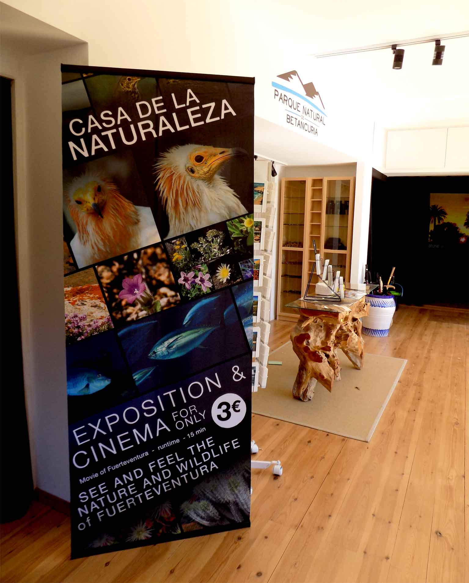
Fuerteventura is a paradise that has endless attractions for tourists and residents. When one arrives in the island thinks of sun and beach tourism, but these Islands really have nature spots that are really worth visiting. We propose five natural jewels in Fuerteventura that you really can’t miss.

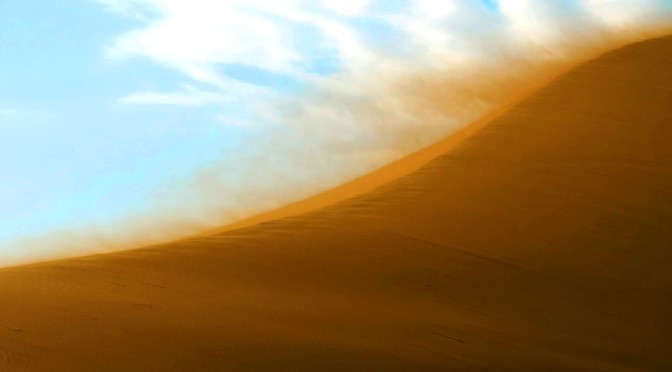
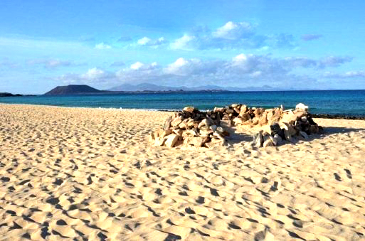
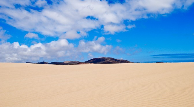
Natural park of dunes in Corralejo

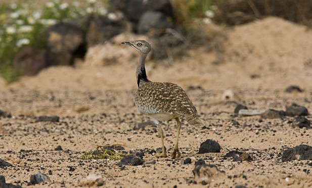
As the name implies, it starts 8 kms from Corralejo, and finishes just at the village entrance. They who stay in Corralejo are lucky to find out these dunes, of impressive natural wealth, in their way from the airport to this village. One is amazed at the beauty of these dunes, the yellowish colour of their fine sand, the views to the islands of Lobos and Lanzarote. They aso stand out because of their scenic value, as they are a shelter for birds and endemic vegetable species in the Canary Islands, reason why they have been declared, together with the islet of Lobos, Special area for bird protection. Visiting these dunes is a true experience for the senses, not just because of their fine yellowish sand but also because of the water at their borders, the beaches of the eastern coast, with crystal clear blue water, so attractive that you’ll feel in paradise.
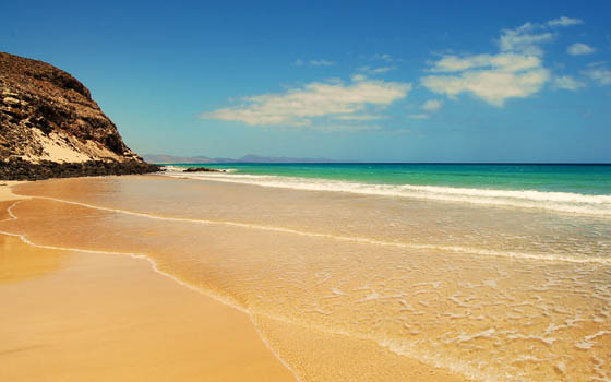
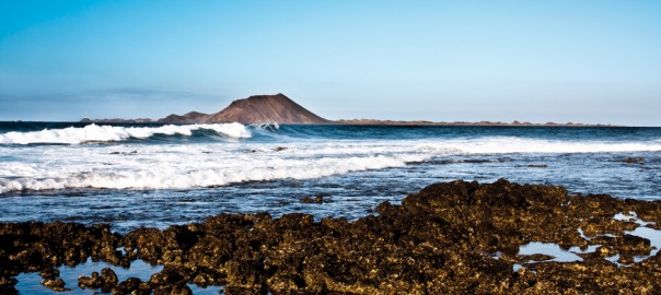
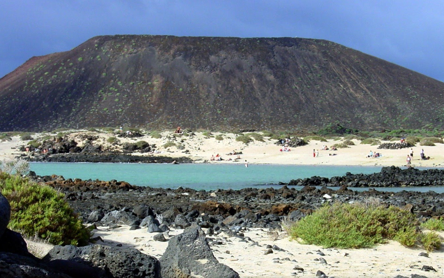
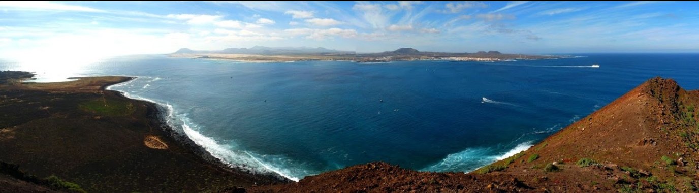
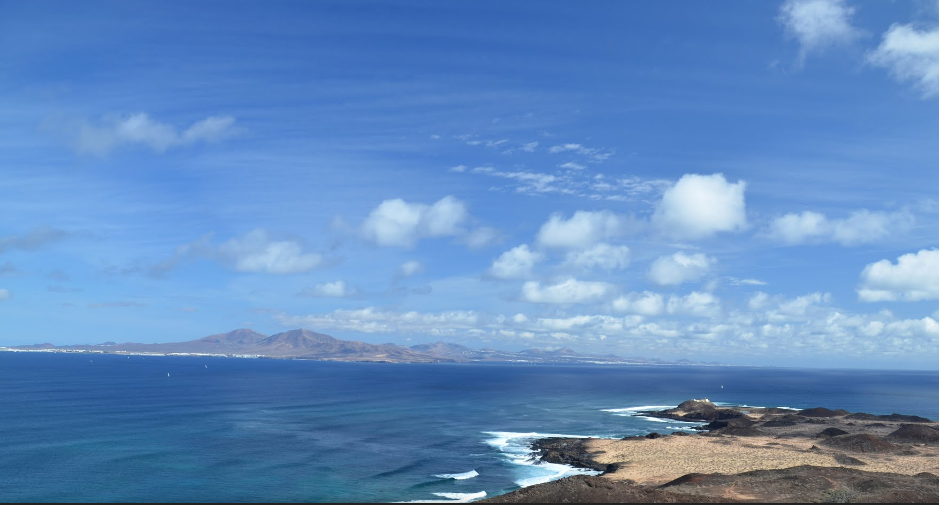
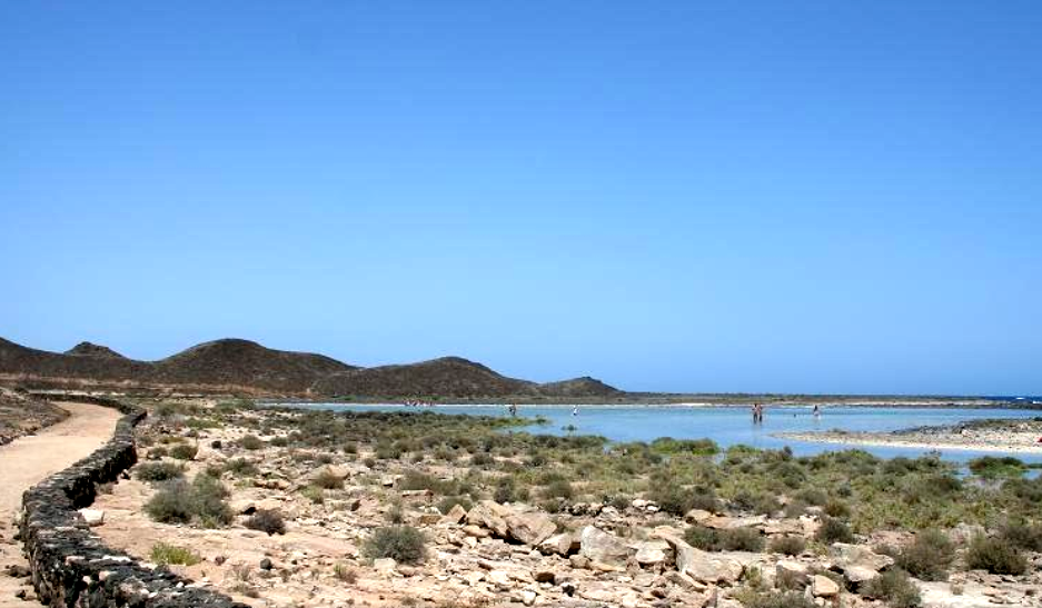
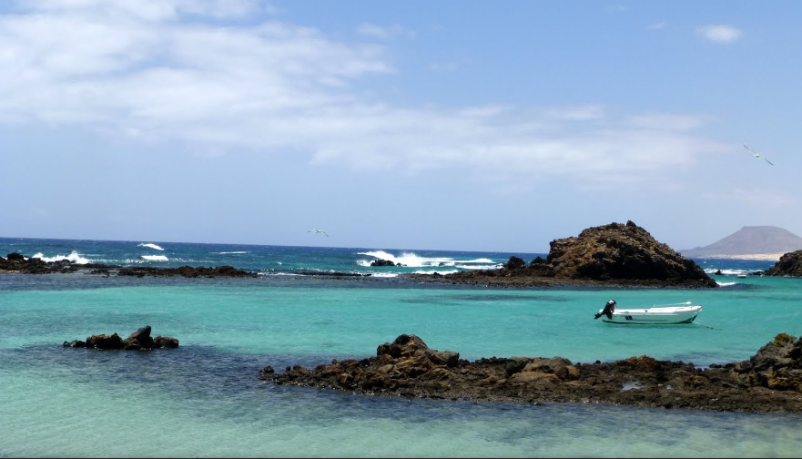
FuerteCharter excursiones | 5 joyas paisajísticas Fuerteventura

Lobos Island

It’s many the articles we have about this little paradise in The Canary Islands, a natural wild island capriciously shaped by the waters of the Atlantic, about 3,5 kms from Corralejo. It’s, no doubt, a must visit spot. It has a little port and fishing village, a volcano and a lighthouse. We recommend to devote at least one morning or afternoon to it, and the best way to enjoy its crystal clear waters is on our boat trips from Corralejo, where apart from enjoying the sea you’ll be able to go down to the island bay on a semi-rigid boat, stroll around this little islet and bathe in the cleanest and most placid waters in The Canary Islands. You can’t leave Fuerteventura without enjoying this island.
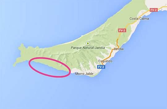
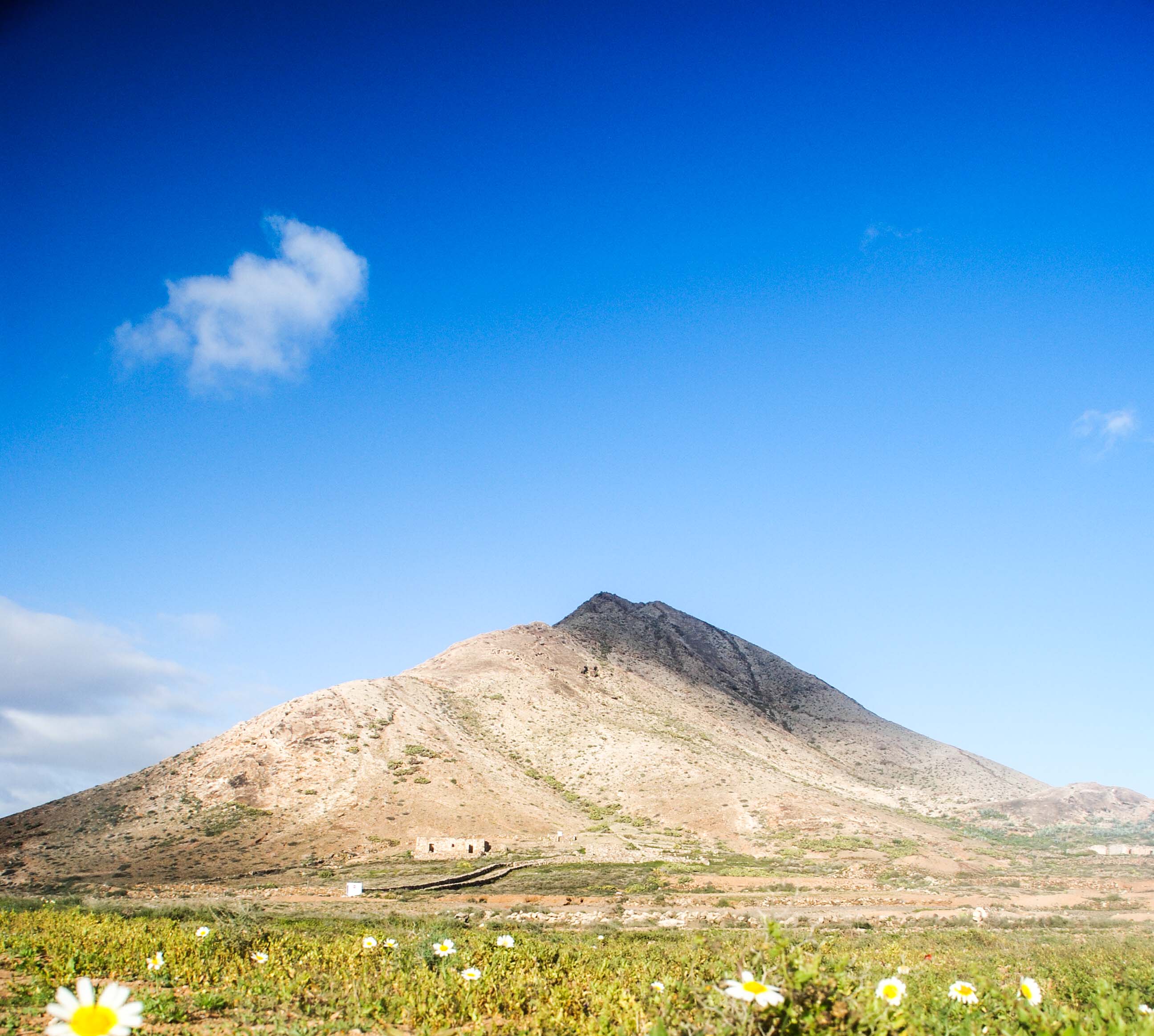
FuerteCharter excursiones | 5 joyas paisajísticas Fuerteventura

“Cofete” Beach

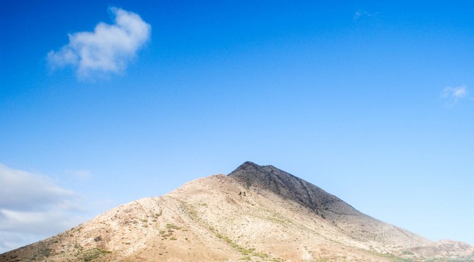
At the other side of the Island, in the western coast and in the south of Fuerteventura, you’ll find the longest beach in Europe and, probably, the least visited, which makes it even more natural and attractive. This beach takes up part of the Jandia peninsula, it’s about 12kms long and 50ms wide. It’s worthwhile to devote one day of your holiday to visit the most virgin of the beaches in The Canary Islands, an impressive place not just because of its dimensions but because of its wild appearance. Careful with the sea at that beach, there are usually strong currents. Apart from enjoying this magnificent beach you’ll be able to visit the Winter house and the little village of Cofete, whiich overlooks El Pico de la Zarza, the highest in Fuerteventura. If you are staying in the north of the island, investing a whole day on this spot is most recommendable.

FuerteCharter excursiones | 5 joyas paisajísticas Fuerteventura

“Las Peñitas” Ravine

This is the natural monument least well known by tourists, and for many it is one of the most interesting natural areas in Fuerteventura. This is a spectacular ravine, made up by huge granite blocks, holding one of the few dams in the island. It’s also the most important place to climb in Fuerteventura. If you like hiking we recommend to go to this ravine along a track connecting Vega del Rio Palmas with the town of Ajuy. In this ravine, apart from its great landscape value you’ll find a little hermitage, La Virgen de la Peña, where every year the most important pilgrimage in Fuerteventura is held. If you drive there you’ll have to go from Pájara to Ajuy and then you’ll find a diversion leading to the ravine, one of the most popular settings in the film Exodus.
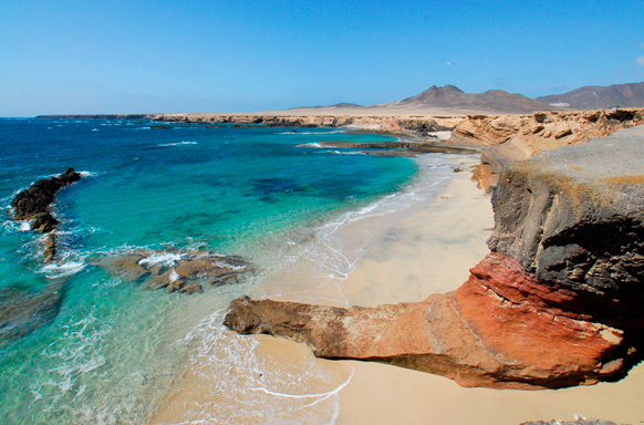
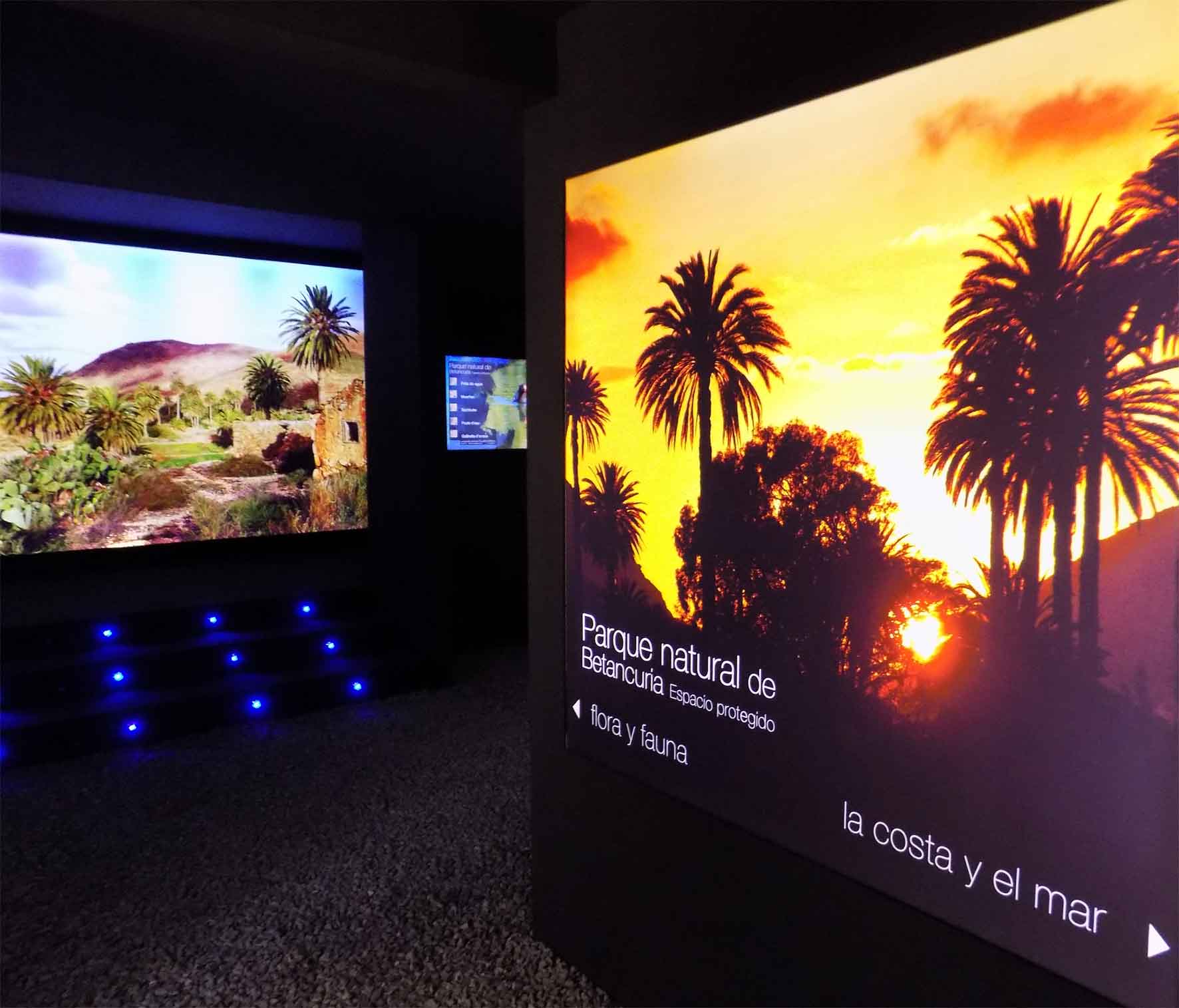
FuerteCharter excursiones | 5 joyas paisajísticas Fuerteventura

Ajuy

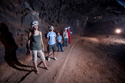
In the western coast of Fuerteventura, in the rural park of Betancuria, we find the village of Ajuy, a little fishing village where you’ll find good restaurants with fresh fish. Its black sand beach reminds us of the volcanic past of this island. But the most popular spot in Ajuy are, no doubt, its caves, to which you can access through a path which starts at the very beach, easy to walk and wonderful because of the beautiful views of the western coast. Besides, this area is made up by the oldest stones in the whole Canary Islands. Another interesting fact t is that in these caves pirates and corsairs used to trade with all kinds of goods.

FuerteCharter excursiones | 5 joyas paisajísticas Fuerteventura
© visitfuerteventura.es

It’s many the natural monuments in Fuerteventura which turn it into a true paradise for visitors, but today we wanted to highlight these five ones. We’ll keep working to bring out the wonders of this little corner of La Macaronesia, which offers so many attractions.

FuerteCharter Team

Beaches sheltered from the wind at Fuerteventura

Fuerteventura, the quiet and apparently unchangeable island, has the characteristic stillness of the dry lands. A space of silent where time seems to stop to capture a landscape which is like a picture that one would like to scan.

Its heavenly beaches invite to relax and observe, to long days of sand and sun bathed in turquoise waters.

Fuertecharter | The wind in Fuerteventura
Los Canarios Beach, Fuerteventura. ©pepecar.com

But so that our sunbathing days are completely satisfactory we have to know and have one of the elements that best define the island on our side: the wind.

Few are the travellers who have visited Fuerteventura without knowing it, who haven’t had their cap blown away on the beach, that haven’t been beaten by the sand on their calves or haven’t looked for shelter from the wind in the “corralitos” of majorera beaches.

Many of their visitors come just looking for those air blasts so as to practise their favourite sports, like windsurf or kitesurf, or just to fly their kites and dye the sky with colours (in ancient times the wind provided a way of earning a living for many families, as it activated the windmills that ground grain); However, for those looking for peace and quiet we’ll suggest some beaches and advice so that their experience in Fuerteventura be unforgettable, even with wind.

Fuertecharter Fuerteventura | Wind and beaches in Fuerteventura
©blog.canariasviaja.com

The first thing to bear in mind is the wind direction. When the wind comes from the East it is more advisable to visit beaches on the West, and the other way around.

Wind barriers are also important, that is, looking for beaches which are sheltered from the wind direction by some barriers, either natural or built. So, for example in the Western coast we find impressive beaches at the mouths of ravines, which are usually beaches sheltered by high cliffs which stop the winds when they aren’t west winds.

Fuertecharter Fuerteventura | Wind and beaches in Fuerteventura
Squinzo’s Beach ©visitfuerteventura.es

They are usually beaches which are difficult to access, which require a bit of skill to reach them (we recommend lots of caution when going down), but once you get there they promise heavenly beach days. You can find this kind of beaches in the North (near El Cotillo) as well as in the South, like “Playa de los Ojos” in Jandia.

Fuertecharter Fuerteventura | Wind and beaches in Fuerteventura
Los Ojos beach: ©visitfuerteventura.es

In the Western coastline, for example Corralejo area, the beaches are protected from West winds thanks to the barrier that the town itself provides. The same happens in the South with the beaches at “avenida marítima” in Morro Jable.

A very recommended area in the island is the one oriented towards the south, in Península de Jandia, where we find quiet water coves sheltered from North winds going in a Westerly or Easterly direction, and also sheltered from heavy swells. Among these coves we find Playa Juan Gómez, known by most of its visitors as one of the best beaches in Spain.

Fuertecharter Fuerteventura | Wind and beaches in Fuerteventura

And in the rest of the beaches in our wonderful coastline, although without barriers that protect them from the winds, we always find these “corralitos”, so characteristic of Fuerteventura’s landscape. They are circular stone constructions, approximately one metre high, which can have different sizes: for a single person, couples or even for whole families. If you get to a beach beaten by the wind and you find one of these constructions don’t hesitate to settle in it. You’ll be able to watch this paradise from the peace and quiet, no matter how strongly the wind outside the walls in your shelter may blow.

Fuertecharter Fuerteventura | Wind and beaches in Fuerteventura
©ifuerteventura facebook

Fuertecharter Team

Tindaya Mountain, natural monument in Fuerteventura

They are several the natural monuments in Fuerteventura —Isla de Lobos is one of them, this is why we enjoy taking tourists to such a setting in our daily excursions— ; one of them, and which we consider a place where memory and magic find shelter is Tindaya Mountain. To the ancient inhabitants of the island (Los Mahos) this is a Sacred Mountain, one of the most important natural monuments in The Canary Islands.

Located 4 kms from the coast, in the ravine of Esquinzo, in the village of Tindaya (municipality of La Oliva), this mountain, 400m above sea level, is a spectacular trachyta python that erosion, over time, has exposed as the volcano that wrapped it wore down and showed it.

Fuertecharter Excursiones Fuerteventura| Montaña de Tindaya

The trachyte is a hard and rough volcanic rock that once was used to make millstones and is now a highly valued ornamental stone used for building and once polished it recalls marble. Geomorphologically, its study is essential to understand the formation of The Canary Islands.
Tindaya has very important cultural, historical and ecological values. Popularly known as the Witches’ mountain, it contains nearly 300 “podomorfos” footprints (foot-shaped engravings), which turn the mountain into one of the largest engraving sites in the planet, similar to those found in North Africa.

“Los podomorfos” in Tindaya Mountain
These foot-shaped engravings were made by different hands at different times, as there are several kinds, in size, execution and distribution. They are spread over more than fifty panels grouped in its upper section and almost thirty loose figures, missing today. We do not know much about these “podomorfos”, all of them oriented towards the sunset, the west; some believe this is because from the top of this mountain, on clear days, you can see Teide Mountain, which ancient inhabitants considered to be Satan’s residence and it might be the target of their rituals, although there are other more plausible theories which relate these footprints with astrological phenomena and Summer and Winter solstices. Other theories speak of nuptial rites … What is undeniable is that this mountain was a ritual site for ancient inhabitants and, therefore, a sacred mountain.

Aboriginal villages
At the foot of this mountain 3 permanent settlements with aboriginal remains have been found, research issues still open, remains of cabins or homes, polished shells and carefully crafted pottery, which seems to belong to rituals rather than to household goods. The oral history or Tindaya tells that games, dances and magical-religious rituals, linked to the stars and supernatural forces, were held there.

Plant and animal species shelter.
The sacred mountain of Tindaya is also shelter for endemic species, many of them unique to Fuerteventura and some, endangered. We’ll highlight “La Chumberilla de Lobos” or “Cernúa” (Caralluma Burchardii). It also serves as a shelter for animals, many of them species in clear decline, classified as rare and uncommon now, as it is the case of the Canary Island Stonechat and the Trumpeter Finch.

Natural Area of ​​National Interest.
For all these values, this area was declared, by 12/1987 Law, of June 19th , on Declaration of Canary Island Natural Areas, as “Paraje Natural de Interés Nacional de Montaña Tindaya” and reclassified as natural monument by 12/1994 Law, of December 19th, on Natural Areas of the Canary Islands.

One of the most beautiful living monuments in the Canary Islands
Tindaya is culture, history, magic and nature; it is a natural monument worthy of respect and research to clarify the past of this land, that of the ancient inhabitants of this corner of La Macaronesian who, like us, felt the magnetism that turns it into the Witches’ Mountain, one of the most beautiful living monuments in the Canary Islands.

Climbing this mountain is now banned but you can stroll around to feel its majesty, also visible from different areas in northern Fuerteventura and recognizable for its special rock, different from other mountains or volcanoes on the island.
They are already several the recommendations of must spots to visit and discover in this island; our favourite one will always be the tour around Isla de Lobos in one of our daily excursions from Corralejo; it is so recommendable that we are number one on TripAdvisor so, will you miss it?

FuerteCharter Team

Fuerteventura, stopping place for the Sandwich Tern

The Sandwich Tern (Sterna sandivecensis) is a migrant seabird that nests on the European coast of Sweden, British Isles, Germany, Denmark, Poland, Brittany and Baltic countries; Also on the shores of the Black sea and the Caspian Sea and in North and Central America.

Those living in Europe fly over the coastal area each year from northern Europe to West and Southern Africa, in search of warmth in winter. In this journey, coasts and wetlands of the Canary Islands, are a must stop for these birds, although compared to the migration that exists in the African coast, in the Canary Islands we can say that this phenomenon is less relevant.

Description
The Sandwich Tern belongs to the order of Charadriiformes, family Laridae, and it has an average size (41cm long and 94cm wingspan).
Its feathers are black, white and gray. Its round head has a kind of black bun (pileus), which in the mating season can cover almost its entire head. Its beak is long and black with yellow tip and its tail is forked.

Excursiones Fuertecharter | Charran Patinegro en Fuerteventura

Flying habits
The Sandwich Tern’s flight is similar to the gulls’, very agile and light, featuring longer and narrower wings though, which makes them more graceful.

Feeding
They eat fish on the beaches and in coastal waters; also molluscs and marine worms. They don’t usually move beyond the continental shelf to forage, and once they have located their prey they pounce on it, plunging into the water.

Reproduction
The Sandwich Tern is a very sociable bird that usually creates dense colonies of thousands of individuals. Within the colony, each specimen with its partner lay their eggs (1 or 2) by the end of April or early May. They don’t build elaborate nests, they just use a hole in the gravel, sand or between two stones, and they usually cover it with vegetation.
Their eggs have a creamy colour with lots of black speckles, and they incubate them, both father and mother, for 22 to 26 days. 15 days after hatching chicks gather in groups that are watched by an adult, and 30 days later they fly the nest for the first time.

Excursiones Fuertecharter | Charran Patinegro en Fuerteventura
©es.paperblog.com

Habitat
In Fuerteventura we find the Sandwich Tern in ponds, lagoons or lowlands, especially in the area of ​​the beaches of Sotavento (Jandía), El Cotillo, Corralejo, Majanicho, and inland areas, like in Rosa Catalina Garcia, in Los Molinos Dam and in some ravines with permanent water.

Migration and presence on the islands
This bird is regular in this land, so we can find specimens on the islands in almost every month of the year, there are even some that spend the winter on our shores, but when we find the most of them is in autumn (August and September) when they come down to Africa searching winter warmth, and in spring (March and April), when they go back to northern Europe.

What determines how long these birds spend on our shores is the peace and quiet they find here and the availability of food to refuel and continue their journey. The manipulation of the environment by man, such as road building or construction, can modify the habitats of these species, by seeking best places to rest.

Fuertecharter Team

La cueva del Llano, a book about the history of Fuerteventura

Just at a glance at Fuerteventura or Isla de Lobos, at their strange shapes, majestic cliffs eroded by the strength of the Atlantic, volcanoes that despite the passage of time still show us their craters, the wonderful “malpaís” that covers a great part of this land, … you can perceive the volcanic past of these islands. A history of strong eruptions that have reached our days offering us a different and spectacular landscape worthy of admiration.

La cueva del LLano

Fuerteventura island is the oldest one in the Canary Islands. In order to know many secrets of the past of this island we can visit “La Cueva del Llano”, a centre that allows us to delve into the depths of the earth, letting us know which animals inhabited the island  thousands of years ago.


What is “La Cueva del  Llano”?

It is a paleontological site located in the town of Villaverde, municipality of La Oliva, about 8 kilometres from Corralejo (headquarters for our excursions to Isla de Lobos) that was formed by the eruption of the mountain of Escanfraga 800.000 years ago.
The eruption of this volcano caused a river of lava flows that solidified at the top by contact with air, while the bottom remained smooth, descending to the sea. Once this eruption was complete the result was an empty tunnel which forms a volcanic pipe which is up to 12 meters wide and up to 5 metres high at the highest parts, it even reaches 7 metres at some point. The surveyed length so far is 648 meters though the last 200 are difficult to scan.

Cueva del Llano

An open book on the past

This lava tube is an open book on the past of this land as “La Cueva” has worked as a drain of water in the area; due to the collapse of part of its roof, “El Jameo” was formed,  which gives access to it and through which streams of water and mud have slipped for centuries, sweeping sediments of the different stages and remains of fossilized animals which still remain there. Its walls, despite the passage of time, still retain the traces of this mud; as a result, the scientific community has bioclimatic samples to investigate the past of this island.

“La Cueva del Llano” is today an interpretation centre whose visit allows us to dive deeper into this lava tube tunnel walking a few meters, a guided tour on the soils of this island, where you will discover its richness. Before diving into the depths of the cave, visitors can discover the geological variety of Fuerteventura in the interpretation centre.

Cueva del Llano


An exceptional inhabitant

This tube has an inhabitant of exception: the harvestman arachnid (Maiorerus randoi), similar to the spider, but yellowish, and unique to “La Cueva del Llano”, being the only cavity in Fuerteventura with appropriate environmental conditions; this is one of the most extraordinary species of invertebrate in the fauna of The Canary Islands. It is a small arachnid adapted to living in the darkness of the cave, so it is almost transparent as it has lost pigmentation and sight due to the darkness; therefore it uses two front legs as sticks to feel its way. It is believed that the ancestors of this arachnid arrived in the Canary Islands in wetter times, millions of years ago, living on the surface, and due to climate change it sought refuge in the cave where it found an ideal habitat.
This Interpretation Centre is a monument of nature. An exceptional place to know and understand the evolution of the climate in Fuerteventura. It is also the oldest lava tube in the Canary Islands and probably one of the best preserved. Today it reopens Wednesday and Thursday, 10-15 hours. Saturdays from 15-18 hours to delight those who want to know more about the majestic volcanic past of these islands.


Therefore besides recommending the visit to Isla de Lobos on one of our trips from Corralejo, to enjoy the beauty of this volcanic landscape that  Lobos preserves even dramatically wild and natural, we recommend visiting the depths of Fuerteventura to understand and learn first hand the history of these islands.


FuerteCharter Team

Hiking the island of Lobos

For those who enjoy nature walks, the island of Lobos, which we visit every day in our boat trips, is a beautiful enclave, which contains singularities that will astonish the hiker, being a Natural Park, which was declared as such in October 1982, when El Parque Natural de las Dunas de Corralejo e Isla de Lobos was created, and reclassified as Natural Park in December 1994.

The following table lists the MIDE characteristics (communication system between hikers, with a scale that includes the technical and physical difficulties of the trails, to allow each hiker a better choice), where we can see that the difficulty of  the trail is minimal.

Fuertecharter | Trekking Lobos Islet

The trail that crosses the island represents the first stage of Fuerteventura GR-131 (long distance footpath linking the Canary Islands with the European path A7, about 5000kms, that departs from Hungary), so this step is particular, being in a separate islet to be accessed by boat.

The adventure of this stage begins on the boat that takes you to Lobos Harbour, through what is known as El Río, a sea canal that separates the islet of Lobos from  Fuerteventura just over one mile and where if we look closely we can admire some of the marine species that ply these waters, such as turtles, flying fish and even dolphins and other cetaceans.

Lobos Harbour will welcome us with its calm turquoise waters, and once the sailing is over the  hiking adventure begins.

Upon arrival at Lobos Harbour we find two trails. We will take the one on the left, since the right trail leads to the houses of Puertito, which are not included in the tour, but we recommend visiting them at the end of this stage of the trail, because of its landscape beauty and calm.

In the chosen path we’ll go through the volcanic “malpaís”, characteristic of the islet and the whole of Fuerteventura, up to Playa de la Calera (or Playa de La Cocha), with its fine sand and almost static water, which invite visitors to relax with water and sun baths.

Fuertecharter | Trekking Lobos Islet
©Peter Connolly

After a pause which can be used to take a dip, we continue the path, leaving the amazing Mountain Caldera on the left, with its 127-meter volcanic cone, swept away by the sea, which has turned the crater into a semicircular amphitheater at whose base the water breaks.

Fuertecharter | Trekking Lobos Islet
©Pedro I

We continue our journey, surrounded by the striking green of the Sweet Tabaibas (Euphorbia balsamifera), which are the exceptional inhabitants of this island, up to Caleta de La Madera, which we will sail round to finally get to Martino’s Lighthouse, located in the northern side of the islet of Lobos, which represents the final stage.

Fuertecharter | Trekking Lobos Islet
©bubueti

At this point there is a crossroads;  those who wish it can return the same path , but we suggest an alternative way (outside the GR trail), which also leads to El Puertito, crossing  Las Lagunitas, which are wetlands (salt marsh near the coast that is affected by the flow of the tide; the sea water is held and it makes ponds or lagoons parallel to the coast that allow the settlement of endemic plant species and also the least representative in our Islands; all these species have in common the adaptation to high salinity conditions), where you can find plenty of species, among which the houseleek (Limonium ovalifolium ssp. Canariense) stands out, endemic to the islet of Lobos.

Fuertecharter | Trekking Lobos Islet
©Alejandro Esquivel Ramos

Through this path back we also find cisterns and lime kilns, which tell about  the history of this magical islet.

Finally we’ll get to the houses which make up the village of Puertito, old fishing settlement which fishermen often visit nowadays to spend the weekends, except some of them who still live on the islet permanently.

Fuertecharter | Trekking Lobos Islet
©Calvin Leung

If you follow the links in this article you will find all the information about this  paradise islet.
FuerteCharter Team.

Gorse blooming in Fuerteventura


If you’ve been lucky enough to take a trip to Lobos Islet from Corralejo you’ll have noticed, when setting foot on land, some peculiar and very characteristic thin greenish bushes: the gorse (Launacea arborescens). It’s just now (March) when these plants begin to bloom, a period which expands until June.

These shrubs are characteristic not only of Lobos and Fuerteventura but of The Canary Islands in general. In Fuerteventura and Lobos these shrubs you can be seen almost all over their surface, probably less common in the highlands.
It is a perennial plant, very abundant in the dry and arid lowlands in the Canary Islands. It can grow up to one meter, so they are not very high; their stems are thin, rounded and dull green.

FuerteCharter excursiones | Flora Fuerteventura

It’s so abundant and representative in our island that the famous writer, Unamuno, who spent his exile in these lands, dedicated a few words to this plant in “Artículos y discursos sobre Canarias”:

“La aulaga majorera, de Fuerteventura —se llama majoreros a los de Fuerteventura— tiende su triste verdor pardo, su verduras gris, por entre pedregales sedientos. La aulaga no tiene hojas, la aulaga desdeña la hojarasca; la aulaga no es más que un esqueleto de planta espinosa. Sus desnudos y delgados tallos, armados de espinas, no se adornan más que con unas florecillas amarillas. Y todo ello se lo come el camello, el compañero del hombre en esta isla, su más fiel servidor (…). Qué lección de estilo y de lo más íntimo del estilo, esta aulaga de Fuerteventura, es la expresión de la isla misma; es la isla misma expresándose, diciéndose; es la palabra suprema de la isla. En la aulaga ha expresado sus entrañas volcánicas, el poso de su corazón de fuego, esta isla entrañable.” Unamuno

We chose the words of this great writer because they describe, with beauty and wisdom, this so abundant bush in our Islands.
Throughout the years and being so abundant, this plant has had many uses, including the gorse yellow flowers which, on their own or in small bunches, were used in infusion for children suffering from jaundice. As already mentioned by Unamuno, it was also the favourite food of camels and goats.

FuerteCharter excursiones | Flora Fuerteventura

Whether you inhabit these lands or are just visiting it, in the coming months you’ll enjoy the flowers of this shrub, which is “the expression of the island itself.” If you’re lucky enough to accompany us on our trip to Lobos from Corralejo you will see this blooming paradise. We’ll be waiting for you.

FuerteCharter Team.

FuerteCharter excursiones | Flora Fuerteventura

FuerteCharter excursiones | Flora Fuerteventura

Foam salt, Fuerteventura

Throughout history, a whole cultural and commercial world has developed around salt. In Fuerteventura, already since the times of the Mahos (ancient aboriginal inhabitants), salt was part of their culinary culture, using salt water to cook and preserve food.

It’s already at the time of the conquest by the Spanish lords (1402-1496) when this sea resource begins to be used and managed, thus developing the salt farming activity.

Between the sixteenth and eighteenth centuries a true salt industry was created in Fuerteventura , with different areas of operation. Although currently only Las Salinas del Carmen (Antigua) remains active, as from the nineteenth century industrial processes left craft aside,  in ancient times there were farms in La Hondurilla (Caleta de Fuste),  El Charco (Puerto del Rosario), Gran Tarajal and the island of Lobos in Marrajo area where, in our daily trips to the neighbouring island, the remains of these salt farming areas can still be observed.
Today, thanks to the creation of the “Centro de Interpretación de la Sal” in Las Salinas del Carmen, the ancient craft of salt maker has been kept, and the visitor can discover how salt is produced on the island in the traditional way.

Salt marshes are characterised by two factors:
- First, to produce salt on clay soils where, when water evaporates, the salt that is produced also acquires salts  from the soil, so their nutritional values ​​are much richer.
- And second, because the sea water used in these salt marshes is surface water, which is the best. Generally, in other salt marshes, sea water is transported to the cookers through pipes using pumps, so it is water from the depths, but at Las Salinas del Carmen water directly gets into the salt marsh after breaking the waves, therefore, what comes in is actually lots of whipped foam, which produces a high quality salt: what is known as foam salt.
So this  foam salt from Fuerteventura is a premium product which is becoming a gourmet product in some markets such as Japan, and it is easier to find in fine dining restaurants.
Numerous studies have shown the benefits of this salt foam in contrast to common salt.

Process
Once the wave breaks and enters the salt marsh, it’s directed to the heaters, which are some areas where water is reserved for 8 to 10 days, to get heated.
After these days, the salt maker takes it to the cookers or pits, where it remains another 15 or 20 days, and water evaporates in the sun, leading to the formation of salt crystals. During this period the salt maker should mix the piles of salt with a rake twice a day, at sunrise and sunset, so that  the crystals that are formed on the surface go to the bottom and allow the formation of more crystals. This is what is known as salt skimming.

Excursiones FuerteCharter | Sal de espuma de Fuerteventura

© pellagofio.es

Then salt piles in “balaches”, which are edges  of cookers or pits, and there it remains piled for a week, and from there it goes to the warehouse to be packaged.

Excursiones Fuertecharter | Sal de espuma de Fuerteventura
© cabildofuer.es

Generally the process of obtaining salt starts in March, and it often extends to October (some years even later,  if the rainy seasons hasn’t started). The rest of the year the work of the salt maker is to keep the salt in perfect conditions, cleaning the pits in depth and building new ones for the next season.
We recommend a tour around Centro de Interpretación de la Sal de Las Salinas del Carmen, where visitors can discover all the ins and outs of this craftsmanship so related to the sea around us.
Hours: Tuesday to Saturday, 10am to 18pm.

FuerteCharter Team


Birds: The Canarian Houbara, inhabitant of The Islet of Lobos, Fuerteventura and Lanzarote


The arid, wild and pristine islet of Lobos —which we passionately show to the visitors who join our day trips from Corralejo— is one of the few places along with Fuerteventura, Lanzarote and La Graciosa, where one of the most unique bird in the Spanish wildlife lives, the Canarian Houbara. Its habitat are the arid landscapes, “jables” and “malpaís” characterizing the eastern end of The Canary Islands.

The Houbara or Houbara Bustard (Chlamydotis undulata) is a species of “gruiforme” birds from the Otididae family, fully adapted to living in dry and poor lands; It is an omnivore, a terrestrial and lonely bird found from Mauritania to Egypt and from Sinai to Mongolia, the small settlement in The Canary Islands being unique in Europe. The subspecies inhabiting our islands is fuerteventurae, which is endemic to The Canary Islands.

FuerteCharter excursions Fuerteventura | Birds: The Canarian Houbara
© AurelioMartín
www.canariasmedioambiente.com

Description

Thin and elongated neck, grey and white shades, it features a comb or small bun of black and white feathers, usually flashier in the male. The chicks, more similar to males, have the duller plumage. Actually this bird seeks to go unnoticed, is easily scared and jealous of its privacy and it seeks to be relaxed for survival so its plumage usually blends in with the landscape except in the mating season. With 170 cm wingspan, it is the largest bird nesting in The Canary Islands. Their diet is varied both animal matter (beetles, grasshoppers, ants, caterpillars, snails and small lizards) and plants (flowers, sprouts, fruits and seeds).

Although the Canarian Houbara is sedentary it can act like the migratory birds, making journeys in search of similar habitats and even flying between islands.

FuerteCharter excursions Fuerteventura | Birds: The Canarian Houbara
© www.canariasmedioambiente.com

Reproduction, wooing and breeding

Regarding the breeding season, although variable, we can say that it normally starts between February and March and it begins with a wooing which is most interesting since the male performs solo shows, a real dance in which their plumage become more attractive so as to draw the females attention; they spread out the white feathers on their crest and neck, moving in circles and straight; from a distance a flashiest white ball, which changes colour, can be seen, a spectacular wooing dance.
Once the female is captivated , after copulation, the male ignores the upbringing and it’s the female that is in charge alone. It usually lays two or three eggs which she incubates for about 23 days, after which the eggs hatch and the chicks are able to move soon after being born and they will be raised by their mother for about 35 days; perhaps occasionally the male may cooperate, but not generally. The chicks usually remain with their mother until the autumn.
This endemic bird of the islands, so special and of which we may have about 800 specimens in the archipelago, is listed as an endangered species, threatened with losing their habitat, their peace and quiet, as a result of urban and tourism development and, particularly in Fuerteventura , by the new highway that goes through the quiet and sparsely populated areas that have become home to these peculiar and solitary birds. For the preservation and survival of the species it is essential to protect their habitat.


Threats and preservation

The preservation measures started in 1985 with the drafting of a recovery plan and management programs, education and awareness and implementation of a captive breeding plan. Since 1993, SEO / BirdLife is carrying out preservation projects in Fuerteventura, subsidized with funds from the EU LIFE program. In 2005, this NGO acquired a 200-acre farm, El Cercado de El Jarde, aimed to protect this species, where 18 specimens have been living along with several other species of the “majorera” wildlife.

It ‘s a bird that could be classified as difficult to see despite being a terrestrial animal since, as we previously said, it’s very jealous of its privacy, but let’s not lose hope because it is common to see it in very quiet areas running around elusively among the gorse. If you are a respectful traveller and concerned about respecting the peace and quiet in these arid areas they inhabit you are much more likely to enjoy them. As for us, on our trips to the Islet of Lobos from Corralejo, we are very attentive when we set foot on the islet because although it is not the most common bird sometimes we are lucky to see them running around in this little paradise that The Islet of Lobos is. 


FuerteCharter Team

The house of Nature: fauna and flora in “Parque Natural de Betancuria”

Just one week ago  the House of Nature opened in the town of Vega de Rio Palmas,, a space dedicated to the exhibition of fauna and flora wonders in the Natural Park of Betancuria in Fuerteventura.

This house, built on the ruins of an ancient majorera house, is owned by the German Reiner Loos, who has been living in Fuerteventura for 20 years, and has managed to give a touch of fantasy to this place, raising a rustic-style building with lots of vegetation and gardens, and with a restaurant for visitors to rest, if they come from the path SL FV 27 (Barranco de las Penitas-Vega de Rio Palmas), enjoying the majestic views of Betancuria mountains.

Fuertecharter | fauna y flora Parque Natural Betancuria

In this House of Nature you find a really modern exhibition hall, where visitors can discover some of the unique fauna and flora in the Natural Park of Betancuria.

Fuertecharter | fauna y flora Parque Natural Betancuria

This park became a National Park in 1987, and in 1994 it also became a Rural Park, the “Natural Monument of Ajuy”being then included in their confines.  It is also a ZEPA  area (Special Protection Area for birds).

The Park includes the area in the west-central sector of the island, covering an area of ​​16,544.3 hectares in the municipalities of Betancuria, Antigua, Puerto del Rosario, Pájara and Tuineje (as you can see in the picture below).

Fuertecharter | fauna y flora Parque Natural Betancuria

This area corresponds to the basal outcrop in Fuerteventura, and it also presents sub-aerial volcanic series, so the colour and structural peculiarities of this area are stunning. There are moderate mounds that intermingle with U-shaped deep ravines. The most prominent peaks of this massif are Morro Jana (764 m), Gran Montaña (708 m), Morro de la Cruz (676 m) and Morro Velosa (669 m), major mountains considering the island scenario.

The existence of mountains and canyons are participant of the great variety of vegetation that exists, many of these rock plants being considered as endangered and protected species.

You can find there endemic species from Fuerteventura , but also from The Canary Islands and the whole of Macaronesia. In lower areas we find a blanket of sparse grass, with few trees and many shrubs, mainly sweet spurge (Euphorbia balsamifera), “cuernúa” (Caralluma buchardii), “ jorjao” (Nauplius asteriscus seiceus), gorse (Launaea arborescens is given ), the cactus (Euphorbia canariensis) and “salados” (Sarcocornia perennis). In ravine funds there are tamarisks (Tamarix canariensis and T. africanus), palm trees (Phoenix canariensis), reeds, rushes, etc. Among the introduced species the mime (Nicotiana glauca) stands out, as well as  the population of pine trees known as “Pinar de Betancuria”.

Fuertecharter | fauna y flora Parque Natural Betancuria

The same can be said about its wildlife, with great variety, especially on humid ravines and inland areas, where you can find native birds such as the  majorero vulture (Neophron percnopterus majorensis), the tit (Parus caeruleus degener) and the canary (Serinus canaria), and other migratory birds such as the marbled teal (Marmaronetta angustirostris) and the Ruddy Shelduck (Tadorna ferruginea).

Fuertecharter | fauna y flora Parque Natural Betancuria

The habitat that stands out is not only the mountain, but also The wetland in the dam of Las Peñitas , Los Molinos, and the coastal cliffs are of great importance. In these cliffs, specifically in the town and Ajuy, you can find important deposits of ancient remains, with ocean sediments and fossils of already extinguished marine animals. The waters in this part of the coast are inhabited by species such as the whale shark, sea turtle, swordfish, sparidae, whales, rays…

Fuertecharter | fauna y flora Parque Natural Betancuria

Fuertecharter | fauna y flora Parque Natural Betancuria

In the House of Nature, visitors can enjoy an exhibition with photos, videos and information on these species of the Flora and Fauna in the Natural Park of Betancuria, besides a projection room where a multi-screen film is exhibited, which portrays the island in all four seasons.

Fuertecharter | fauna y flora Parque Natural Betancuria

Part of the exhibition hall is dedicated to ecological disasters that produced tar in the Galician coast (Prestige) as a protest to this industry and a rejection of the implementation of these platforms on the shores of our paradise.

Fuertecharter | fauna y flora Parque Natural Betancuria

Fuertecharter | fauna y flora Parque Natural Betancuria

Hours: 10 to 17h. Closed on Tuesday.

FuerteCharter Team